File:Province of Chetumal map.tif

Size of this JPG preview of this TIF file: 440 × 599 pixels. Other resolutions: 176 × 240 pixels | 352 × 480 pixels | 564 × 768 pixels | 752 × 1,024 pixels | 1,644 × 2,238 pixels.
Original file (1,644 × 2,238 pixels, file size: 3.51 MB, MIME type: image/tiff)
Captions
Captions
Province of Chetumal / 1957 map by R. L. Roys / via HathiTrust
Summary edit
| Description |
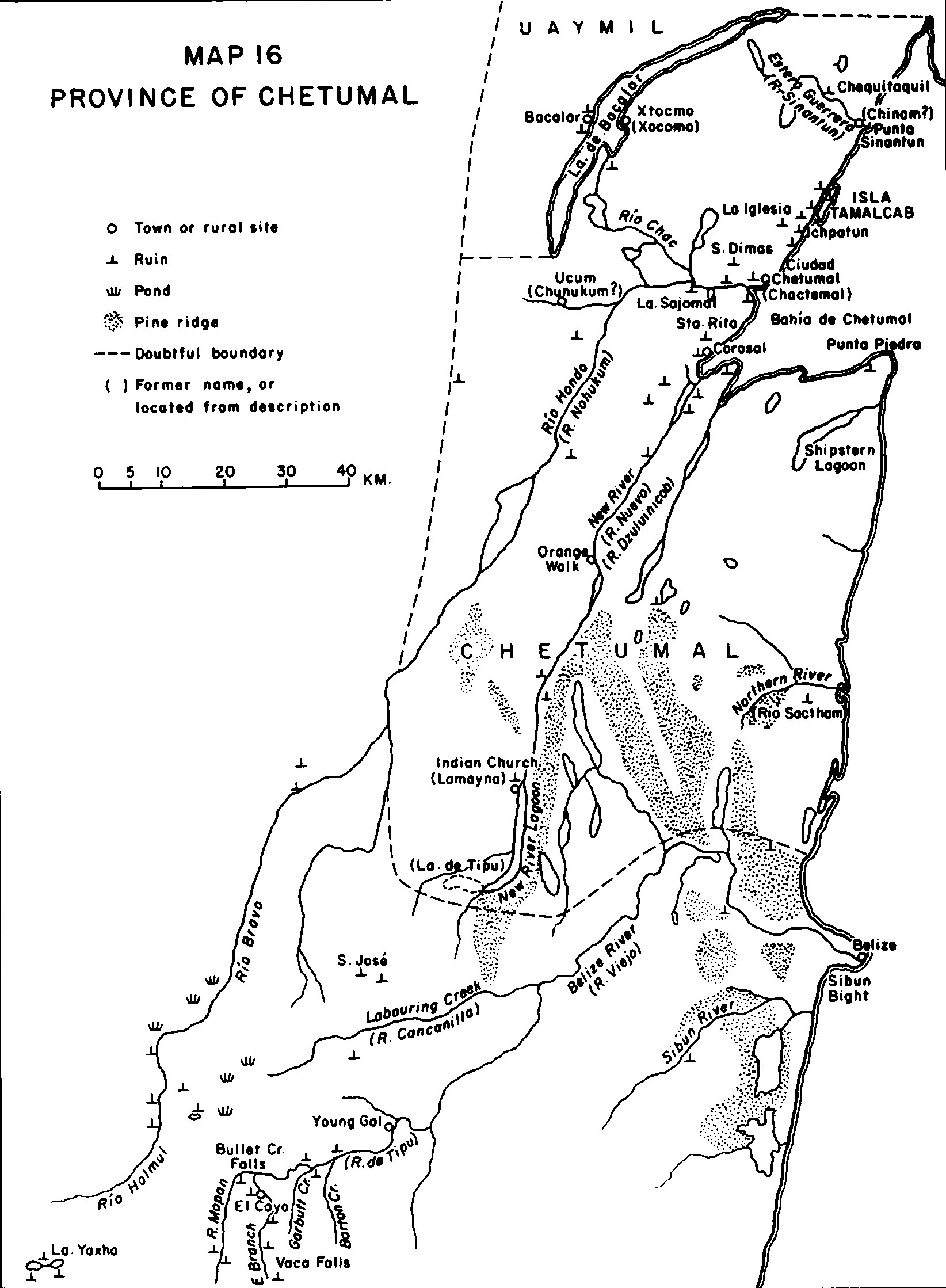
English: Map 16 in page 160 of The political geography of the Yucatan Maya by Ralph L. Roys [1957, hdl = https://hdl.handle.net/2027/uva.x000422247, licensed under CC0 per HathiTrust] / scale and legend included |
| Date | |
| Source | https://hdl.handle.net/2027/uva.x000422247?urlappend=%3Bseq=168%3Bownerid=27021597765720347-172 |
| Author | Ralph L. Roys |
Licensing edit
| This file is made available under the Creative Commons CC0 1.0 Universal Public Domain Dedication. | |
| The person who associated a work with this deed has dedicated the work to the public domain by waiving all of their rights to the work worldwide under copyright law, including all related and neighboring rights, to the extent allowed by law. You can copy, modify, distribute and perform the work, even for commercial purposes, all without asking permission.
|
File history
Click on a date/time to view the file as it appeared at that time.
| Date/Time | Thumbnail | Dimensions | User | Comment | |
|---|---|---|---|---|---|
| current | 07:38, 7 August 2023 |  | 1,644 × 2,238 (3.51 MB) | Asdfjrjjj (talk | contribs) | Uploaded a work by Ralph L. Roys from https://hdl.handle.net/2027/uva.x000422247?urlappend=%3Bseq=168%3Bownerid=27021597765720347-172 with UploadWizard |
You cannot overwrite this file.
File usage on Commons
There are no pages that use this file.
File usage on other wikis
The following other wikis use this file:
- Usage on en.wikipedia.org