File:Ptolemy Cosmographia 1467 - Mediterranean Middle East.jpg
Size of this preview: 800 × 569 pixels. Other resolutions: 320 × 227 pixels | 640 × 455 pixels | 1,024 × 728 pixels | 1,280 × 910 pixels | 1,531 × 1,088 pixels.
Original file (1,531 × 1,088 pixels, file size: 1.29 MB, MIME type: image/jpeg)
Captions
Captions
Add a one-line explanation of what this file represents
Summary edit
| Cosmographia Claudii Ptolomaei Alexandrini | |
|---|---|
| Author |
Jacob d'Angelo after Claudius Ptolemaeus |
| Title |
Cosmographia Claudii Ptolomaei Alexandrini |
| Language | Latin |
| Publication date | 1467 |
| Place of publication | Reichenbach Monastery |
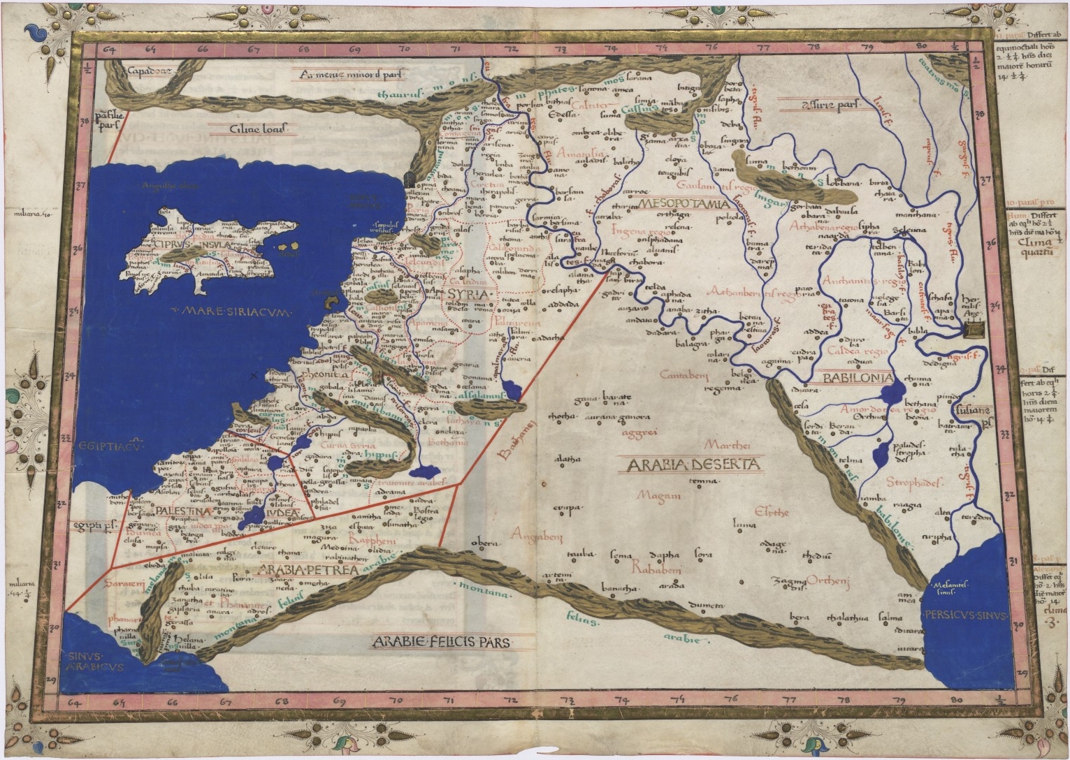
| English: Ptolemy's 4th Asian Map.
Polski: Bliski Wschód. ( |
||||||||||||||||||||||||
|---|---|---|---|---|---|---|---|---|---|---|---|---|---|---|---|---|---|---|---|---|---|---|---|---|
| Artist |
Nicolaus Germanus |
|||||||||||||||||||||||
| Title |
English: Ptolemy's 4th Asian Map.
Polski: Bliski Wschód. |
|||||||||||||||||||||||
| Date | 1467 | |||||||||||||||||||||||
| Medium | ink and color on parchment | |||||||||||||||||||||||
| Dimensions | height: 28.8 cm (11.3 in); width: 42 cm (16.5 in) | |||||||||||||||||||||||
| Collection |
|
|||||||||||||||||||||||
| Current location |
Warsaw |
|||||||||||||||||||||||
| Accession number |
Rps BOZ 2/I-II |
|||||||||||||||||||||||
| Object history |
1573: transferred to Chancellor Jan Zamoyski (purchased in Paris) |
|||||||||||||||||||||||
| Notes |
English: Dedicated to Pope Paul II. |
|||||||||||||||||||||||
| Source/Photographer | www.polona.pl | |||||||||||||||||||||||
| Permission (Reusing this file) |
Copyright expired, PD-Art | |||||||||||||||||||||||
| Other versions |
|
|||||||||||||||||||||||


Licensing edit
|
This is a faithful photographic reproduction of a two-dimensional, public domain work of art. The work of art itself is in the public domain for the following reason:
The official position taken by the Wikimedia Foundation is that "faithful reproductions of two-dimensional public domain works of art are public domain".
This photographic reproduction is therefore also considered to be in the public domain in the United States. In other jurisdictions, re-use of this content may be restricted; see Reuse of PD-Art photographs for details. | ||||
File history
Click on a date/time to view the file as it appeared at that time.
| Date/Time | Thumbnail | Dimensions | User | Comment | |
|---|---|---|---|---|---|
| current | 23:19, 19 January 2008 | | 1,531 × 1,088 (1.29 MB) | Peacay (talk | contribs) | {{Information |Description=Map of Mediterranean Middle East |Source=National Digital Library of Poland[http://www.polona.pl/dlibra/doccontent2?id=61&dirids=1] |Date=1467 |Author=Nicolaus Germanius (after Ptolemy (Geographia): 1st/2nd centuy AD) |Permissio |
You cannot overwrite this file.
File usage on Commons
The following 3 pages use this file:
- File:Fourth map of Asia (Middle east and Cyprus), in full gold border (NYPL b12455533-427047).tif
- File:Ptolemy, 2nd cent. Quarta Asie tabula continet Cyprum & Syrium & Iudea & vtraq-ue-, Arabia petream & deserta ac Mesopotamia & Babilonia. 1482.jpg
- File:Ptolemy Cosmographia 1467 - Mediterranean Middle East.jpg
File usage on other wikis
The following other wikis use this file:
- Usage on ar.wikipedia.org
- Usage on bs.wikipedia.org
- Usage on en.wikipedia.org
- Usage on he.wikipedia.org
- Usage on hr.wikipedia.org
- Usage on sh.wikipedia.org