File:Public footpath - geograph.org.uk - 612324.jpg
Public_footpath_-_geograph.org.uk_-_612324.jpg (640 × 360 pixels, file size: 59 KB, MIME type: image/jpeg)
Captions
Captions
Summary edit
| Description |
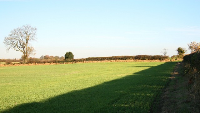
English: Public footpath. This easterly facing photograph shows a footpath linking the 608845¹ near Astwith (ahead) with North Wingfield (behind the viewpoint).
This section of the footpath (between a junction with the Five Pits Trail and the B6039) crosses three fields. The photograph was taken in the middle field (autumn sown crop) where the footpath follows the field boundary to a stile leading into a field bordering the B6039. To see a photograph taken from the same viewpoint but facing the opposite direction, click here 612326. From the corner of the field ahead there is this 612386. For a more easterly (ahead) photograph of the footpath, click here 612580. For a more westerly (behind the viewpoint) photograph of the footpath, click here 612254. ¹ Road name information from OS Maps at:- Elgin, http://www.elgin.gov.uk/ and the Mapping Portal of the Derbyshire Partnership, http://derbyshiremaps.derbyshire.gov.uk/ |
| Date | |
| Source | From geograph.org.uk |
| Author | Alan Walker |
| Attribution (required by the license) | Alan Walker / Public footpath / |
| Camera location | | View this and other nearby images on: OpenStreetMap |
|---|
_heading:90.00&language=en)
| Object location | | View this and other nearby images on: OpenStreetMap |
|---|
_heading:90.00&language=en)
Licensing edit

|
This image was taken from the Geograph project collection. See this photograph's page on the Geograph website for the photographer's contact details. The copyright on this image is owned by Alan Walker and is licensed for reuse under the Creative Commons Attribution-ShareAlike 2.0 license.
|
- You are free:
- to share – to copy, distribute and transmit the work
- to remix – to adapt the work
- Under the following conditions:
- attribution – You must give appropriate credit, provide a link to the license, and indicate if changes were made. You may do so in any reasonable manner, but not in any way that suggests the licensor endorses you or your use.
- share alike – If you remix, transform, or build upon the material, you must distribute your contributions under the same or compatible license as the original.
- Remove redundant categories and try to put this image in the most specific category/categories
- Remove this template
- The location categories are based on information from this geonames tool and this OpenStreetMap tool combined with a database. You can also have a look at this tool from mysociety.
- The topic category from Geograph was Farmland (find similar images at Geograph)
File history
Click on a date/time to view the file as it appeared at that time.
| Date/Time | Thumbnail | Dimensions | User | Comment | |
|---|---|---|---|---|---|
| current | 03:22, 7 February 2011 | | 640 × 360 (59 KB) | GeographBot (talk | contribs) | == {{int:filedesc}} == {{Information |description={{en|1=Public footpath This easterly facing photograph shows a footpath linking the 608845¹ near Astwith (ahead) with North Wingfield (behind the viewpoint). This section of the footpath (between a |
You cannot overwrite this file.
File usage on Commons
There are no pages that use this file.