File:Punjab map de.svg

Size of this PNG preview of this SVG file: 800 × 490 pixels. Other resolutions: 320 × 196 pixels | 640 × 392 pixels | 1,024 × 627 pixels | 1,280 × 784 pixels | 2,560 × 1,568 pixels | 955 × 585 pixels.
Original file (SVG file, nominally 955 × 585 pixels, file size: 58 KB)
Captions
Captions
Add a one-line explanation of what this file represents
Summary edit
| Description |
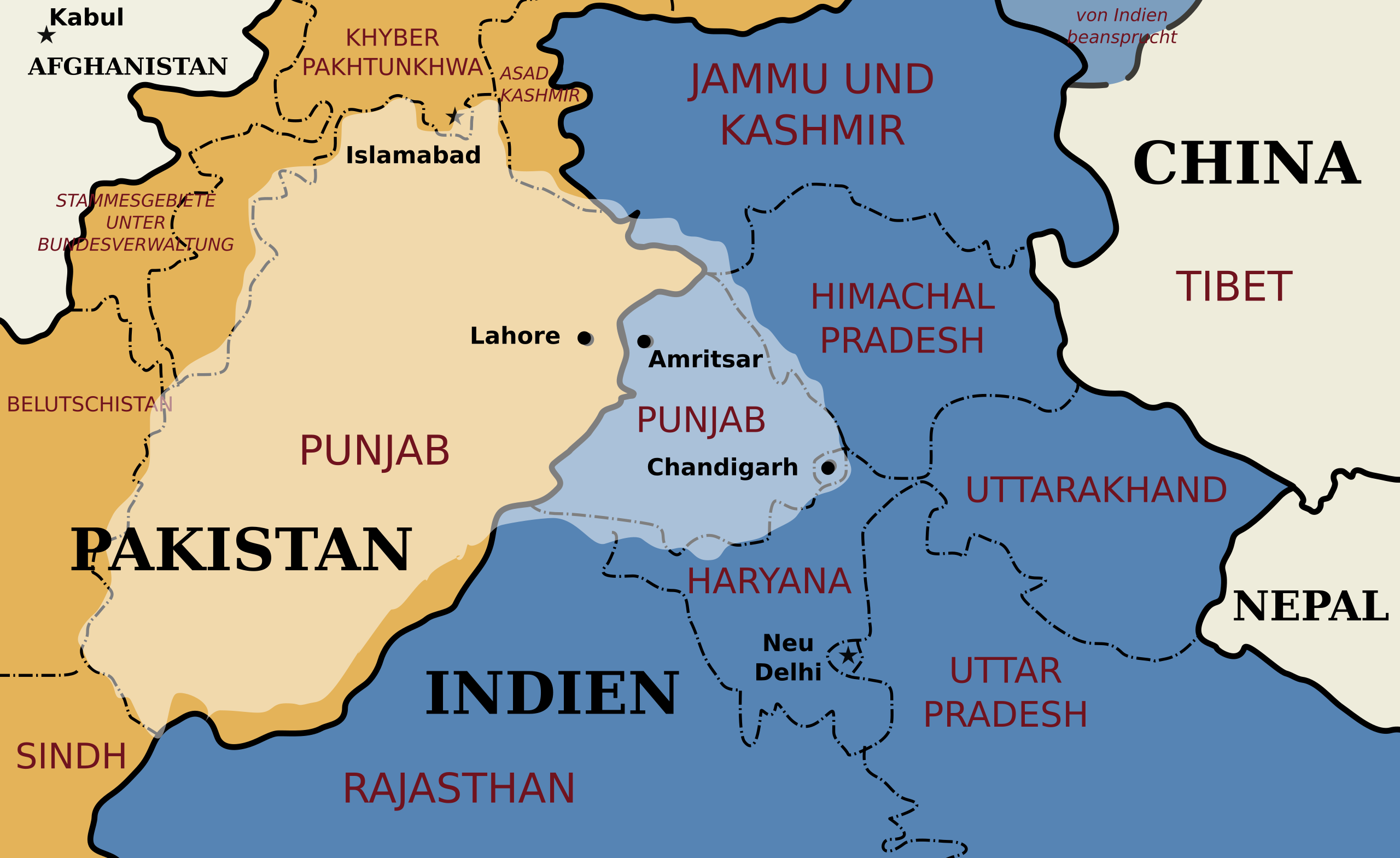
Deutsch: Karte der historischen Region Punjab vor dem Hintergrund der heutigen politischen Grenzen. English: Map of Punjabi region, created by me in Inkscape. |
| Date | 14 October 2012, 11:05 (UTC) |
| Source |
This file was derived from: Punjab map.svg: |
| Author |
Later version(s) were uploaded by Nichalp at English Wikipedia.
|
| Other versions |
[]
|


| This is a retouched picture, which means that it has been digitally altered from its original version. Modifications: German translation / Deutsche Übersetzung. The original can be viewed here: Punjab map.svg:
|
Licensing edit
I, the copyright holder of this work, hereby publish it under the following licenses:
| This file is licensed under the Creative Commons Attribution-Share Alike 3.0 Unported license. Subject to disclaimers. | ||
| ||
| This licensing tag was added to this file as part of the GFDL licensing update. |

|
Permission is granted to copy, distribute and/or modify this document under the terms of the GNU Free Documentation License, Version 1.2 or any later version published by the Free Software Foundation; with no Invariant Sections, no Front-Cover Texts, and no Back-Cover Texts. A copy of the license is included in the section entitled GNU Free Documentation License. Subject to disclaimers. |
You may select the license of your choice.
Original upload log edit
This image is a derivative work of the following images:
- File:Punjab_map.svg licensed with Cc-by-sa-3.0-migrated-with-disclaimers, GFDL-en, GFDL-user-en-with-disclaimers
- 2011-02-22T03:59:02Z Ras67 955x585 (59124 Bytes) black frame removed
- 2009-01-01T18:54:21Z RaviC 968x598 (67457 Bytes) {{Information |Description={{en|Created by me in Inkscape.}} |Source=Transferred from [http://en.wikipedia.org en.wikipedia]; transferred to Commons by [[User:RaviC]] using [http://tools.wikimedia.de/~magnus/commonshelper.php
Uploaded with derivativeFX
File history
Click on a date/time to view the file as it appeared at that time.
| Date/Time | Thumbnail | Dimensions | User | Comment | |
|---|---|---|---|---|---|
| current | 11:09, 14 October 2012 | | 955 × 585 (58 KB) | Furfur (talk | contribs) | Bildkosmetik |
| 11:05, 14 October 2012 |  | 955 × 585 (58 KB) | Furfur (talk | contribs) | == {{int:filedesc}} == {{Information |Description={{de|Karte der historischen Region Punjab vor dem Hintergrund der heutigen politischen Grenzen.}}{{en|Map of Punjabi region, created by me in Inkscape.}} {{pa|[[:pa... |
You cannot overwrite this file.
File usage on Commons
The following 9 pages use this file:
File usage on other wikis
The following other wikis use this file: