File:Quincy MA geography.png

Size of this preview: 779 × 600 pixels. Other resolutions: 312 × 240 pixels | 623 × 480 pixels | 997 × 768 pixels | 1,280 × 986 pixels | 2,371 × 1,826 pixels.
Original file (2,371 × 1,826 pixels, file size: 893 KB, MIME type: image/png)
Captions
Captions
Add a one-line explanation of what this file represents
Summary edit
| Description |
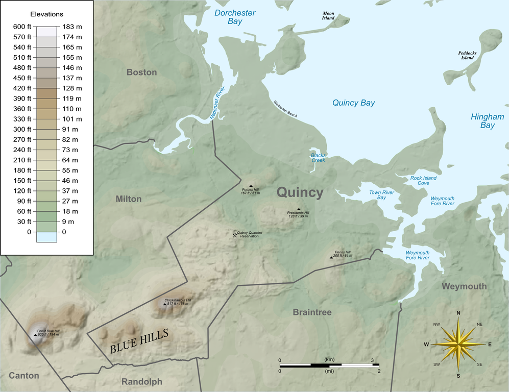
English: Relief map of Quincy, Massachusetts showing features and elevations. |
| Date | |
| Source |
Own work by uploader, using Quantum GIS, Inkscape and Gimp based on public data from Office of Geographic and Environmental Information (MassGIS), Commonwealth of Massachusetts Executive Office of Environmental Affairs - http://www.mass.gov/mgis/dd-over.htm |
| Author | Sswonk |
| Camera location | | View this and other nearby images on: OpenStreetMap |
|---|
Licensing edit
| I, the copyright holder of this work, release this work into the public domain. This applies worldwide. In some countries this may not be legally possible; if so: I grant anyone the right to use this work for any purpose, without any conditions, unless such conditions are required by law. |
File history
Click on a date/time to view the file as it appeared at that time.
| Date/Time | Thumbnail | Dimensions | User | Comment | |
|---|---|---|---|---|---|
| current | 14:06, 16 October 2009 | | 2,371 × 1,826 (893 KB) | Sswonk (talk | contribs) | Fix water background alpha |
| 14:05, 16 October 2009 |  | 2,371 × 1,826 (1.02 MB) | Sswonk (talk | contribs) | Addition of Quincy Quarries Reservation; Wollaston Beach; Forbes, Penns, and Presidents Hills | |
| 20:35, 7 June 2009 |  | 2,371 × 1,826 (1.29 MB) | Sswonk (talk | contribs) | {{Information |Description={{en|1=Relief map of Quincy, Massachusetts showing features and elevations.}} |Source=Own work by uploader, using Quantum GIS, Inkscape and Gimp based on public data from Office of Geographic and Environmental Information (MassG |
You cannot overwrite this file.
File usage on Commons
The following page uses this file:
File usage on other wikis
The following other wikis use this file:
- Usage on en.wikipedia.org
- Usage on fr.wikipedia.org
- Usage on ja.wikipedia.org