File:Radar image of the 2011 Joplin tornado May 22, 2011 2248Z.png
Size of this preview: 800 × 455 pixels. Other resolutions: 320 × 182 pixels | 640 × 364 pixels | 1,117 × 635 pixels.
Original file (1,117 × 635 pixels, file size: 215 KB, MIME type: image/png)
Captions
Captions
Add a one-line explanation of what this file represents
Summary edit
| Description |
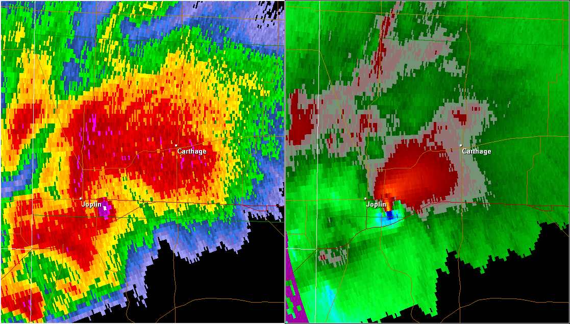
English: A radar image of the supercell that produced the 2011 Joplin tornado. Base reflectivity is on the left and storm relative velocity on the right. The area of high reflectivity just to the right of the Joplin label is debris lofted into the air by the tornado. |
| Date | |
| Source | NWS radar data displayed with GR2Analyst |
| Author | NWS radar data, Gibson Ridge Radar software |
| Permission (Reusing this file) |
Licensing edit

|
The copyright holder of this file allows anyone to use it for any purpose, provided that the copyright holder is properly attributed. Redistribution, derivative work, commercial use, and all other use is permitted. |
|
|
File history
Click on a date/time to view the file as it appeared at that time.
| Date/Time | Thumbnail | Dimensions | User | Comment | |
|---|---|---|---|---|---|
| current | 00:16, 7 December 2011 | | 1,117 × 635 (215 KB) | Ks0stm (talk | contribs) | {{Information |Description ={{en|1=A radar image of the supercell that produced the 2011 Joplin tornado. Base reflectivity is on the left and storm relative velocity on the right. The area of high reflectivity just to the righ |
You cannot overwrite this file.
File usage on Commons
The following page uses this file:
File usage on other wikis
The following other wikis use this file:
- Usage on en.wikipedia.org
- Usage on fr.wikipedia.org
- Usage on hu.wikipedia.org
- Usage on pt.wikipedia.org
- Usage on www.wikidata.org