File:Rail Network Kansas City (Harry S. Truman Bridge).png
Size of this preview: 800 × 415 pixels. Other resolutions: 320 × 166 pixels | 640 × 332 pixels | 1,024 × 531 pixels | 1,280 × 663 pixels | 2,763 × 1,432 pixels.
Original file (2,763 × 1,432 pixels, file size: 4.8 MB, MIME type: image/png)
Captions
Captions
Add a one-line explanation of what this file represents
Summary edit
.png&action=edit§ion=1)
| Description |
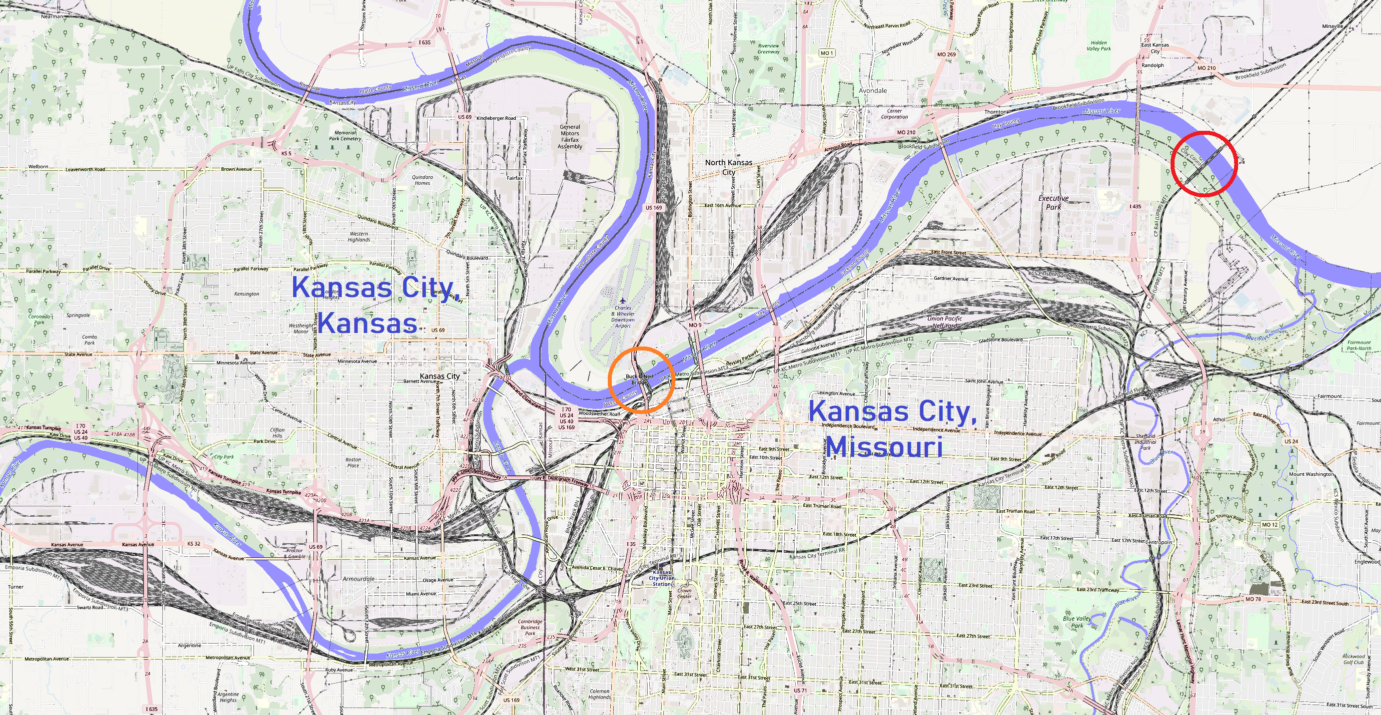
English: Rail Network in Kansas City, adoption of OSM map with highlighted rail network and location of the Harry S. Truman Bridge (red circle) and Hannibal Bridge (orange circle) over the Missouri River |
| Date | |
| Source | https://www.openstreetmap.org/#map=12/39.1231/-94.5854 |
| Author | OpenStreetMap contributors |
Licensing edit
.png&action=edit§ion=2)
This file is licensed under the Creative Commons Attribution-Share Alike 2.0 Generic license.
- You are free:
- to share – to copy, distribute and transmit the work
- to remix – to adapt the work
- Under the following conditions:
- attribution – You must give appropriate credit, provide a link to the license, and indicate if changes were made. You may do so in any reasonable manner, but not in any way that suggests the licensor endorses you or your use.
- share alike – If you remix, transform, or build upon the material, you must distribute your contributions under the same or compatible license as the original.
File history
Click on a date/time to view the file as it appeared at that time.
| Date/Time | Thumbnail | Dimensions | User | Comment | |
|---|---|---|---|---|---|
| current | 13:10, 12 March 2022 | | 2,763 × 1,432 (4.8 MB) | Krib (talk | contribs) | mark Hannibal Bridge |
| 07:30, 27 February 2022 |  | 2,763 × 1,432 (4.48 MB) | Krib (talk | contribs) | river color | |
| 15:06, 26 February 2022 |  | 2,763 × 1,432 (4.48 MB) | Krib (talk | contribs) | fix mark Lamar Hunt Memorial Highway | |
| 14:43, 26 February 2022 |  | 2,763 × 1,432 (4.83 MB) | Krib (talk | contribs) | Uploaded a work by OpenStreetMap contributors from https://www.openstreetmap.org/#map=12/39.1231/-94.5854 with UploadWizard |
You cannot overwrite this file.
File usage on Commons
The following 6 pages use this file:
- User:Chumwa/OgreBot/Public transport information/2022 February 19-28
- User:Chumwa/OgreBot/Public transport information/2022 March 11-20
- User:Chumwa/OgreBot/Transport Maps/2022 February 19-28
- User:Chumwa/OgreBot/Transport Maps/2022 March 11-20
- User:Chumwa/OgreBot/Travel and communication maps/2022 February 19-28
- User:Chumwa/OgreBot/Travel and communication maps/2022 March 11-20
File usage on other wikis
The following other wikis use this file:
- Usage on de.wikipedia.org
.png&oldid=638039305)