File:Rail Tracks map Eiden Takaragaike Station.svg

Size of this PNG preview of this SVG file: 420 × 210 pixels. Other resolutions: 320 × 160 pixels | 640 × 320 pixels | 1,024 × 512 pixels | 1,280 × 640 pixels | 2,560 × 1,280 pixels.
Original file (SVG file, nominally 420 × 210 pixels, file size: 14 KB)
Captions
Captions
Add a one-line explanation of what this file represents
| Description |
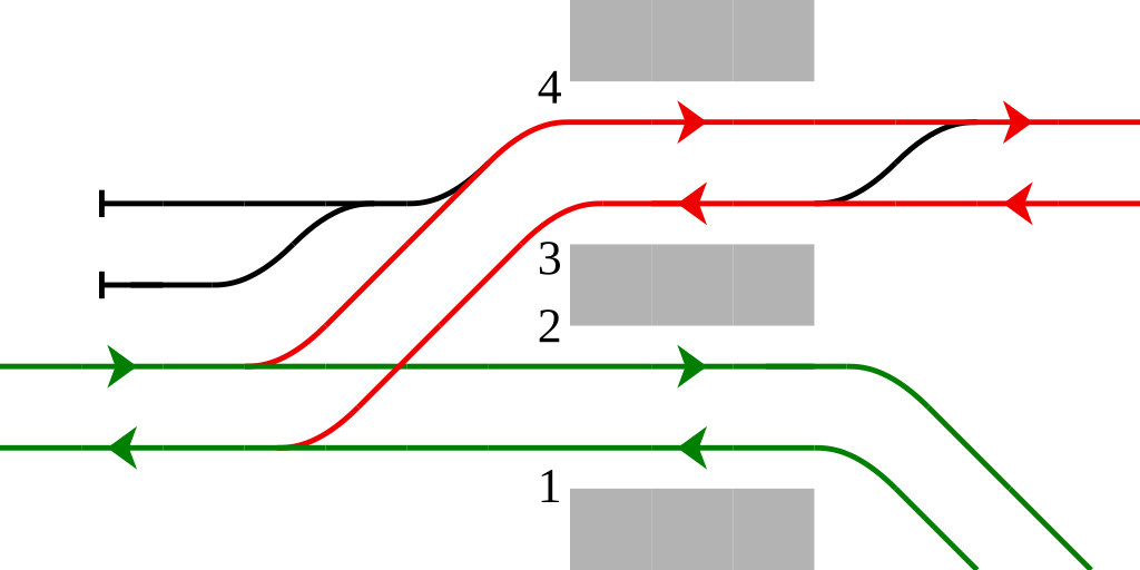
English: Rail tracks map of Eiden Takaragaike Station in Sakyō-ku, Kyoto, Kyoto Pref., Japan.
Reference material: Ryozo KAWASHIMA, "Zenkoku Tetsudo Jijyo Daikenkyu - Kyoto & Shiga", ISBN 978-4-7942-0473-8 , 91p., Soshisha, 1992 Français : fr:Projet:Ferrovipedia/Plan de voies |
||
| Date | |||
| Source | Tawashi2006 created from icons in Category:Rail_tracks_map_template. | ||
| Author | Tawashi2006 with pdv2svg | ||
| Permission (Reusing this file) |
|
File history
Click on a date/time to view the file as it appeared at that time.
| Date/Time | Thumbnail | Dimensions | User | Comment | |
|---|---|---|---|---|---|
| current | 07:01, 22 August 2022 | | 420 × 210 (14 KB) | Seikan Tunnel (talk | contribs) | adding colours |
| 14:24, 7 May 2009 |  | 420 × 210 (7 KB) | Tawashi2006 (talk | contribs) | {{Information |Description={{en|1=Rail tracks map of Eiden Takaragaike Station in Sakyō-ku, Kyoto, Kyoto Pref., Japan.<br /> Refere |
You cannot overwrite this file.
File usage on Commons
The following page uses this file:
File usage on other wikis
The following other wikis use this file: