File:Rail networks USA map.svg

Size of this PNG preview of this SVG file: 800 × 495 pixels. Other resolutions: 320 × 198 pixels | 640 × 396 pixels | 1,024 × 633 pixels | 1,280 × 791 pixels | 2,560 × 1,583 pixels | 959 × 593 pixels.
Original file (SVG file, nominally 959 × 593 pixels, file size: 124 KB)
Captions
Captions
Add a one-line explanation of what this file represents
Summary edit
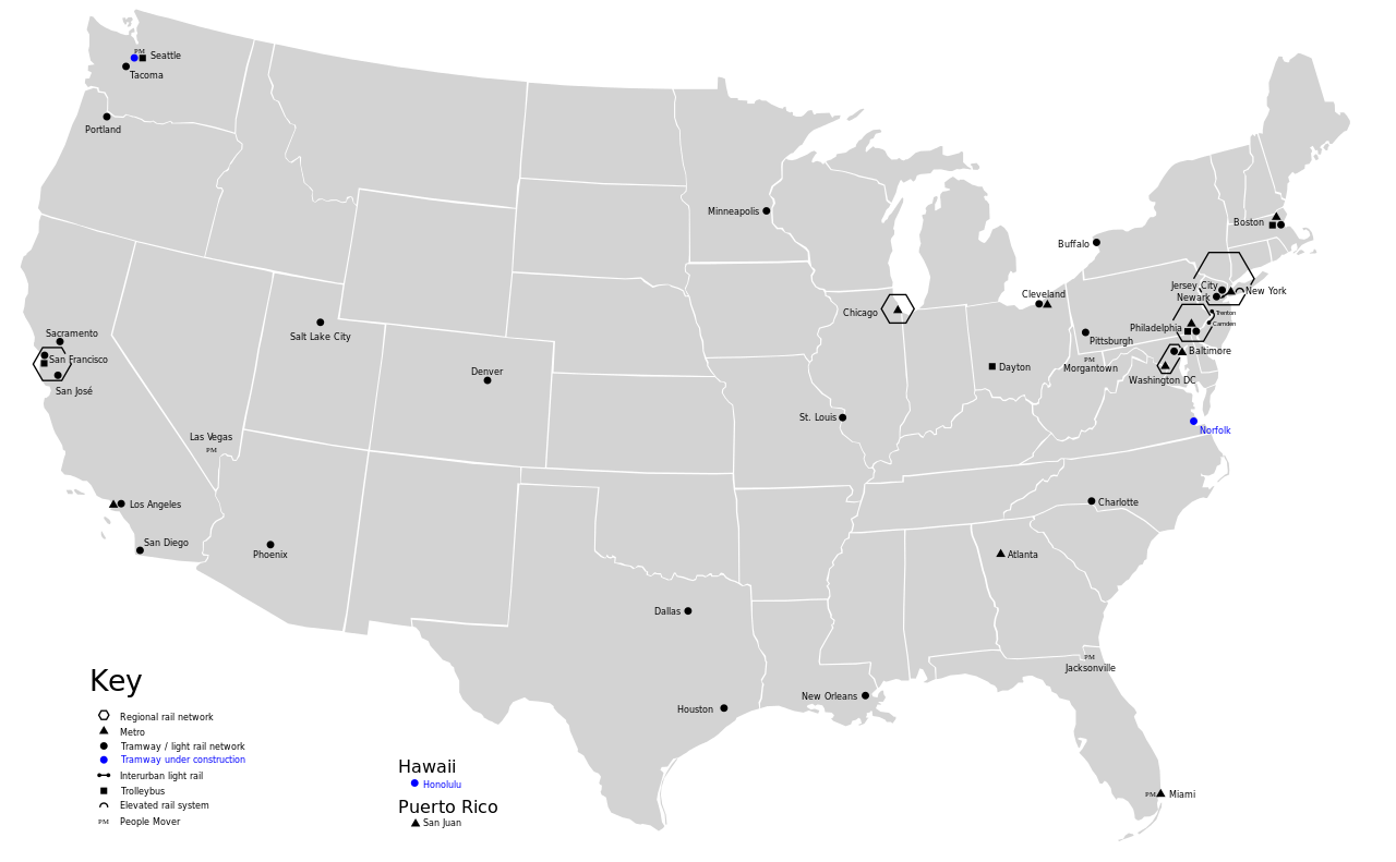
| Description |
English: Rail networks in USA |
| Date | |
| Source | Traced from File:Karte der ÖPNV-Systeme in den USA.png |
| Author | Maximilian Dörrbecker (Chumwa) (original PNG) User:Slashme (SVG) |
| Other versions |
China
Czech Republic France
Germany
Italy
Japan
Korea Poland
Spain & Portugal
Turkey
British Isles Former Soviet Union
Balkans
North Africa
Latin America
United States of America
|


Licensing edit
This file is licensed under the Creative Commons Attribution-Share Alike 2.5 Generic license.
- You are free:
- to share – to copy, distribute and transmit the work
- to remix – to adapt the work
- Under the following conditions:
- attribution – You must give appropriate credit, provide a link to the license, and indicate if changes were made. You may do so in any reasonable manner, but not in any way that suggests the licensor endorses you or your use.
- share alike – If you remix, transform, or build upon the material, you must distribute your contributions under the same or compatible license as the original.
File history
Click on a date/time to view the file as it appeared at that time.
| Date/Time | Thumbnail | Dimensions | User | Comment | |
|---|---|---|---|---|---|
| current | 18:20, 10 August 2009 | | 959 × 593 (124 KB) | Slashme (talk | contribs) | {{Information |Description={{en|1=Rail networks in USA}} |Source=Traced from File:Karte der ÖPNV-Systeme in den USA.png |Author=User:Slashme |Date=2009-10-10 |Permission= |other_versions=File:Karte der ÖPNV-Systeme in den USA.png }} [[Cat |
You cannot overwrite this file.
File usage on Commons
The following 34 pages use this file:
- User:Chumwa/OtherVersions - OePNV-Karten
- File:Carte des transports urbains en France.png
- File:Greater China Rapid Transit.svg
- File:Karte der ÖPNV-Systeme in Deutschland 2008.png
- File:Karte der ÖPNV-Systeme in Lateinamerika.png
- File:Karte der ÖPNV-Systeme in Nordafrika.png
- File:Karte der ÖPNV-Systeme in Spanien und Portugal.png
- File:Karte der ÖPNV-Systeme in den Staaten der ehemaligen Sowjetunion.png
- File:Karte der ÖPNV-Systeme in den USA.png
- File:Karte ÖPNV-Systeme in Italien.png
- File:Karte ÖPNV-Systeme in der Türkei.png
- File:Metro, tram a trolejbusy v ČR.jpg
- File:Metro map of China.svg
- File:Núcleos de Cercanías de Renfe.svg
- File:OePNVSystemeDeutschland.png
- File:OePNVSystemeDeutschlandJanuar2003.jpg
- File:OePNVSystemeFrankreich-fr.png
- File:OePNVSystemeFrankreich.png
- File:OePNVSystemeJapanJanuar2003.png
- File:OePNVSystemePolenMai2007.png
- File:Public transport system map of the USA.png
- File:Public transport systems of Italy.png
- File:Rail networks USA map.svg
- File:Réseaux de trolleybus en France.png
- File:Transports urbains de France.png
- File:Tranvía en España.svg
- File:ÖPNV-System in den Benelux-Staaten.png
- File:ÖPNV-Systeme Tschechische Republik.png
- File:ÖPNV-Systeme auf den Britischen Inseln.png
- File:ÖPNV-Systeme in China.png
- File:ÖPNV-Systeme in Korea.png
- File:ÖPNV-Systeme in Südosteuropa.png
- File:ÖPNV-Südkorea de.svg
- Category:Rapid transit in the United States
File usage on other wikis
The following other wikis use this file:
- Usage on en.wikipedia.org
- Usage on www.wikidata.org