File:Railways in liberia-de.svg

Size of this PNG preview of this SVG file: 799 × 600 pixels. Other resolutions: 320 × 240 pixels | 640 × 480 pixels | 1,023 × 768 pixels | 1,280 × 961 pixels | 2,560 × 1,922 pixels | 3,148 × 2,363 pixels.
Original file (SVG file, nominally 3,148 × 2,363 pixels, file size: 275 KB)
Captions
Captions
Add a one-line explanation of what this file represents
| Description |
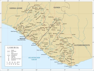
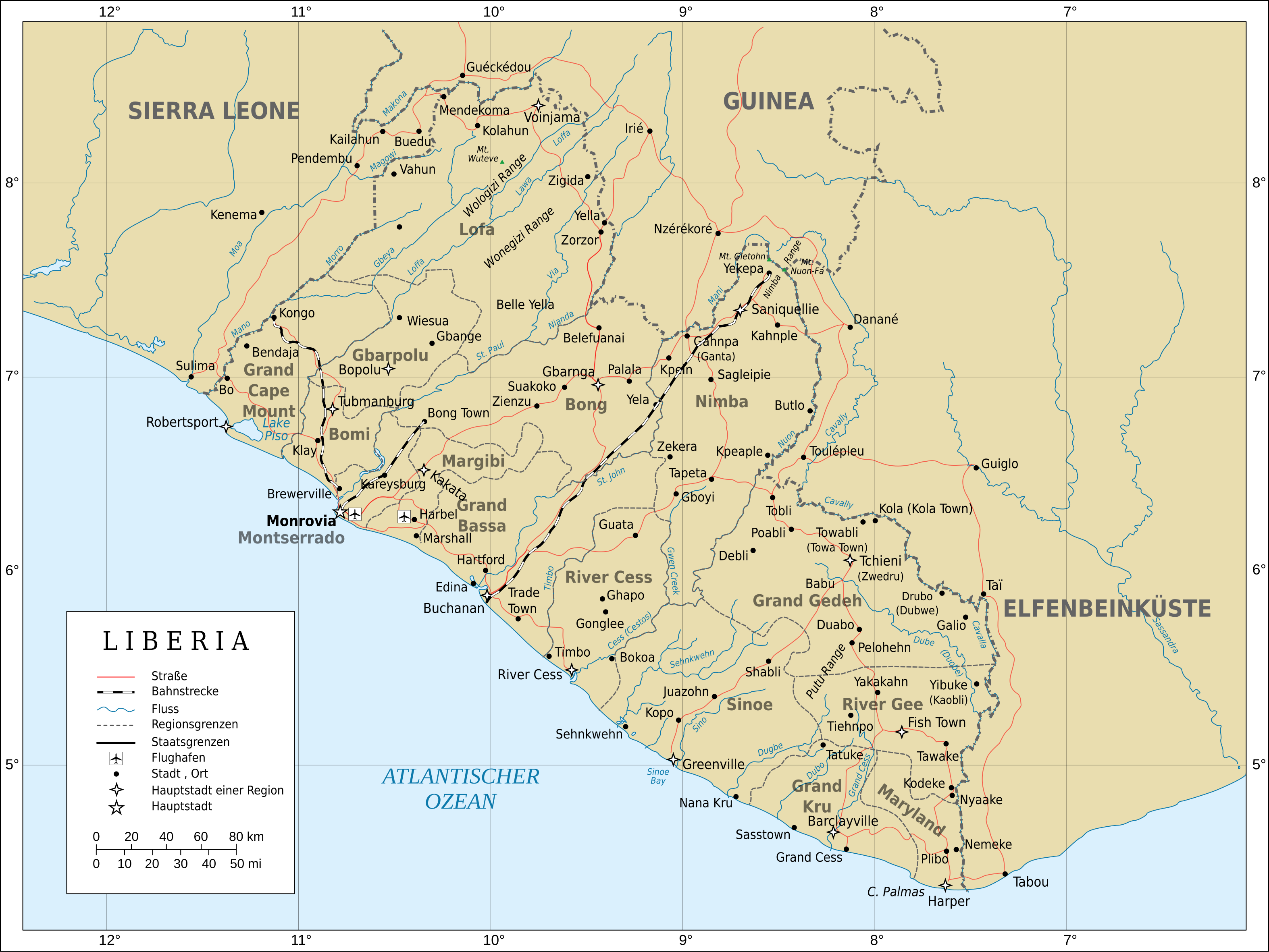
English: Topographic map of Liberia with highlighted railway. English: Topografische Karte von Liberia hervorgehobenen Bahnstrecken |
| Date | (UTC) |
| Source | |
| Author |
|
| This is a retouched picture, which means that it has been digitally altered from its original version. Modifications: highlighted railway, translation. The original can be viewed here: Topographic map of Liberia-en.svg:
|
I, the copyright holder of this work, hereby publish it under the following licenses:
This file is licensed under the Creative Commons Attribution-Share Alike 3.0 Unported, 2.5 Generic, 2.0 Generic and 1.0 Generic license.
- You are free:
- to share – to copy, distribute and transmit the work
- to remix – to adapt the work
- Under the following conditions:
- attribution – You must give appropriate credit, provide a link to the license, and indicate if changes were made. You may do so in any reasonable manner, but not in any way that suggests the licensor endorses you or your use.
- share alike – If you remix, transform, or build upon the material, you must distribute your contributions under the same or compatible license as the original.

|
Permission is granted to copy, distribute and/or modify this document under the terms of the GNU Free Documentation License, Version 1.2 or any later version published by the Free Software Foundation; with no Invariant Sections, no Front-Cover Texts, and no Back-Cover Texts. A copy of the license is included in the section entitled GNU Free Documentation License. |
You may select the license of your choice.
Original upload log edit
This image is a derivative work of the following images:
- File:Topographic_map_of_Liberia-en.svg licensed with Cc-by-sa-3.0,2.5,2.0,1.0, GFDL
- 2010-07-31T20:08:30Z Mysid 3148x2363 (1774722 Bytes) remove the false "dropoff" from land to sea in shading
- 2010-07-31T20:02:34Z Mysid 3148x2363 (1777006 Bytes) fixed a couple of symbols + clipped the shading layer
- 2010-07-19T10:49:48Z Mysid 3148x2363 (2767806 Bytes) argh, forgot to update legend box
- 2010-07-19T10:41:15Z Mysid 3148x2363 (2767864 Bytes) revised for consistency with my other maps
- 2008-05-25T12:46:33Z Mysid 3148x2363 (3004777 Bytes) border in image; layers in XML
- 2008-05-12T18:34:24Z Mysid 3037x2257 (2961332 Bytes) adding lakes, airports, legends
- 2008-05-12T16:44:24Z Mysid 3037x2257 (2945262 Bytes) == {{int:filedesc}} == {{Information |Description= {{en|Topographic map of [[:en:Liberia|Liberia]].}} {{fr|Carte topographique du [[:fr:Liberia|Liberia]].}} {{fi|[[:fi:Liberia|Liberian]] topografinen kartta.}} |Source=Self-ma
Uploaded with derivativeFX
File history
Click on a date/time to view the file as it appeared at that time.
| Date/Time | Thumbnail | Dimensions | User | Comment | |
|---|---|---|---|---|---|
| current | 17:51, 3 December 2010 | | 3,148 × 2,363 (275 KB) | Vuxi (talk | contribs) | und ohne Karomuster |
| 17:50, 3 December 2010 |  | 3,148 × 2,363 (275 KB) | Vuxi (talk | contribs) | Jetzt auch mit ohne Relief | |
| 18:47, 31 October 2010 |  | 3,148 × 2,363 (1.69 MB) | Uwe Dedering (talk | contribs) | without blur-filter | |
| 18:46, 28 October 2010 |  | 3,148 × 2,363 (1.69 MB) | Vuxi (talk | contribs) | Elfenbeinküste jetzt in groß | |
| 18:12, 28 October 2010 |  | 3,148 × 2,363 (1.69 MB) | Vuxi (talk | contribs) | Elfenbeinküste übersetzt | |
| 18:05, 28 October 2010 |  | 3,148 × 2,363 (1.69 MB) | Vuxi (talk | contribs) | legende verbessert | |
| 17:28, 28 October 2010 |  | 3,148 × 2,363 (1.69 MB) | Vuxi (talk | contribs) | {{Information |Description={{en|Topographic map of Liberia.}} {{fr|Carte topographique du Liberia.}} {{fi|Liberian topografinen kartta.}} |Source=*File:Topographic_map_of_Liberia-en.svg |Date=2010-10-2 |
You cannot overwrite this file.
File usage on Commons
There are no pages that use this file.
File usage on other wikis
The following other wikis use this file:
- Usage on de.wikipedia.org
- Usage on en.wikipedia.org
- Usage on ru.wikipedia.org