File:Ranch lands in the Powder River Basin near Colstrip. Long-range plans call for massive strip-mining..., 06-1973 (6919728320).jpg

Original file (3,000 × 1,992 pixels, file size: 469 KB, MIME type: image/jpeg)
Captions
Captions
Summary edit
.jpg&action=edit§ion=1)
| Description |
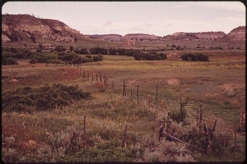
Original Caption: Ranch lands in the Powder River Basin near Colstrip. Long-range plans call for massive strip-mining of the area and the construction of huge power plants capable of producing 200,000 megawatts of power. The power plants would emit more minute separate particles than New York City and Los Angeles combined, 06/1973 U.S. National Archives’ Local Identifier: 412-DA-6670 Photographer: Norton, Boyd Subjects: Environmental protection Natural resources Pollution Billings (Montana, United States) inhabited place Persistent URL: research.archives.gov/description/549156 Repository: Still Picture Records Section, Special Media Archives Services Division (NWCS-S), National Archives at College Park, 8601 Adelphi Road, College Park, MD, 20740-6001. For information about ordering reproductions of photographs held by the Still Picture Unit, visit: www.archives.gov/research/order/still-pictures.html Reproductions may be ordered via an independent vendor. NARA maintains a list of vendors at www.archives.gov/research/order/vendors-photos-maps-dc.html Access Restrictions: Unrestricted Use Restrictions: Unrestricted |
| Date | Taken in June 1973 |
| Source | Ranch lands in the Powder River Basin near Colstrip. Long-range plans call for massive strip-mining..., 06/1973 |
| Author | The U.S. National Archives |
| Permission (Reusing this file) |
The U.S. National Archives @ Flickr Commons |
| Camera location | | View this and other nearby images on: OpenStreetMap |
|---|
.jpg¶ms=045.783660_N_-108.505523_E_globe:Earth_type:camera_source:Flickr_&language=en)
Licensing edit
.jpg&action=edit§ion=2)
This image was taken from Flickr's The Commons. The uploading organization may have various reasons for determining that no known copyright restrictions exist, such as:
More information can be found at https://flickr.com/commons/usage/. Please add additional copyright tags to this image if more specific information about copyright status can be determined. See Commons:Licensing for more information. |
| This image was originally posted to Flickr by The U.S. National Archives at https://flickr.com/photos/35740357@N03/6919728320. It was reviewed on 22 November 2016 by FlickreviewR and was confirmed to be licensed under the terms of the No known copyright restrictions. |
File history
Click on a date/time to view the file as it appeared at that time.
| Date/Time | Thumbnail | Dimensions | User | Comment | |
|---|---|---|---|---|---|
| current | 03:01, 22 November 2016 | | 3,000 × 1,992 (469 KB) | Victorgrigas (talk | contribs) | Transferred from Flickr via Flickr2Commons |
You cannot overwrite this file.
File usage on Commons
There are no pages that use this file.
.jpg&oldid=865190704)