File:Regione Siciliana topographic map-blank.svg

Size of this PNG preview of this SVG file: 517 × 599 pixels. Other resolutions: 207 × 240 pixels | 414 × 480 pixels | 662 × 768 pixels | 883 × 1,024 pixels | 1,766 × 2,048 pixels | 2,812 × 3,260 pixels.
Original file (SVG file, nominally 2,812 × 3,260 pixels, file size: 6.51 MB)
Captions
Captions
Add a one-line explanation of what this file represents
Summary edit
| Description |
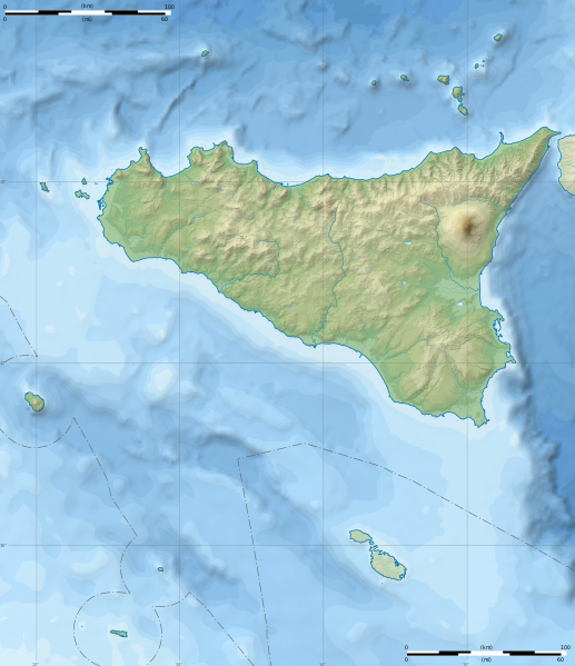
English: Topographic blank map of the autonomous region of Sicily, Italy. It shows the main island of Sicily, Aeolian Islands, Aegedian Islands, Pantelleria and Pelagian Islands. And also the archipelago of Malta.
Equirectangular projection, WGS84 datum. Geographic limits of the map: West: 011° 45' E, East: 015° 45' E, North: 39° 00' N, South: 35° 20' N. Standard meridian: 013° 45' E, True scale parallel: 37° 45' N. Français : Carte topographique de la région autonome de Sicile, en Italie. Elle montre l'île principale de Sicile, les îles Éoliennes, les îles Égades, Pantelleria et les îles Pélages. Ainsi que l'archipel maltais. Projection cylindrique équidistante, système géodésique WGS84. Limites géographiques de la carte : Ouest 011° 45' E, Est 015° 45' E, Nord 39° 00' N, Sud 35° 20' N. Méridien de référence 013° 45' E, parallèle de référence 37° 45' N. |
| Date | (UTC) |
| Source |
English: * Topography and relief: NASA Shuttle Radar Topography Mission (SRTM3 v.2) (public domain)
Français : * Topographie et relief : NASA Shuttle Radar Topography Mission (SRTM3 v.2) (domaine public)
|
| Author | |
| Attribution (required by the license) | © Sémhur / Wikimedia Commons / |
| Other versions |
|
| SVG development |


| Object location | | View this and other nearby images on: OpenStreetMap |
|---|
Licensing edit
I, the copyright holder of this work, hereby publish it under the following licenses:
| Copyleft: This work of art is free; you can redistribute it and/or modify it according to terms of the Free Art License. You will find a specimen of this license on the Copyleft Attitude site as well as on other sites. |
This file is licensed under the Creative Commons Attribution-Share Alike 4.0 International, 3.0 Unported, 2.5 Generic, 2.0 Generic and 1.0 Generic license.
- You are free:
- to share – to copy, distribute and transmit the work
- to remix – to adapt the work
- Under the following conditions:
- attribution – You must give appropriate credit, provide a link to the license, and indicate if changes were made. You may do so in any reasonable manner, but not in any way that suggests the licensor endorses you or your use.
- share alike – If you remix, transform, or build upon the material, you must distribute your contributions under the same or compatible license as the original.
You may select the license of your choice.
File history
Click on a date/time to view the file as it appeared at that time.
| Date/Time | Thumbnail | Dimensions | User | Comment | |
|---|---|---|---|---|---|
| current | 20:59, 22 January 2015 | | 2,812 × 3,260 (6.51 MB) | Sémhur (talk | contribs) | Trait de côte plus épais, pays ou province autre que la Sicile en blanc opacité 40% |
| 12:21, 2 January 2015 |  | 2,812 × 3,260 (6.49 MB) | Sémhur (talk | contribs) | Valid SVG | |
| 15:57, 31 December 2014 |  | 2,812 × 3,260 (6.49 MB) | Sémhur (talk | contribs) | == {{int:filedesc}} == {{Information |Description= {{en|1=Topographic blank map of the autonomous region of en:Sicily, Italy. It shows the main island of Sicily, en:Aeolian Islands, en:Aegedian Islands, en:Pantelleria and [[:en:... |
You cannot overwrite this file.
File usage on Commons
The following 8 pages use this file:
File usage on other wikis
The following other wikis use this file:
- Usage on it.wikipedia.org
- Isole Egadi
- Isola di Favignana
- Isola di Marettimo
- Isola di Stromboli
- Strombolicchio
- Isola di Lampedusa
- Isola di Levanzo
- Isole Pelagie
- Isola Ferdinandea
- Isole Eolie
- Isola Alicudi
- Isola di Pantelleria
- Isola Filicudi
- Isola Lampione
- Isola di San Pantaleo
- Isola di Panarea
- Isola di Salina
- Isola di Lipari
- Isola di Ustica
- Scoglio Giafante
- Isola di Vulcano
- Empedocle (vulcano)
- Grotta del Genovese
- Grotta dell'Uzzo
- Grotta Calafarina
- Punta Pesce Spada
- Isola dei Porri (Sicilia)
- Isola di Linosa
- Monte Falcone
- Vulcano (vulcano)
- Isola dei Conigli
- Isole maltesi
- Monte Luziano
- Isola di Basiluzzo
- Lisca Bianca
- Isola Preveto
- Template:Mappa di localizzazione/Sicilia
- Scoglio Iannuzzo
- Isola La Scuola
- Isola Santa Maria (Sicilia)
- Ipogeo di San Bartolomeo
- Dattilo (isola)
- Scoglio Faraglione
- Scoglio Spinazzola
- Grotta di Sant'Agrippina
- Campi Flegrei del Mar di Sicilia
- Pietra Quaglietto
- Scoglio la Nave
- Scoglio delle Sirene
- Scoglio Palomba
View more global usage of this file.