File:Relief Map of Middle East.jpg

Size of this preview: 800 × 524 pixels. Other resolutions: 320 × 209 pixels | 640 × 419 pixels | 1,024 × 670 pixels | 1,500 × 982 pixels.
Original file (1,500 × 982 pixels, file size: 330 KB, MIME type: image/jpeg)
Captions
Captions
Add a one-line explanation of what this file represents
Summary edit
| Description |
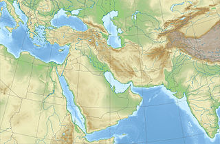
Русский: Физическая карта Ближнего и Среднего Востока
x = 50.0 + 143.2394488 * (2.238026669-({{{2}}}*pi / 180)) * sin(0.497465385 * ({{{1}}} - 50) * pi / 180) * 0.654
y = 50 - 143.2394488 * (1.714427893 - (2.238026669-({{{2}}}*pi / 180)) * cos(0.497465385 * ({{{1}}} - 50) * pi / 180))
|
| Date | |
| Source | |
| Author | |
| Other versions |
[] |


Licensing edit
This file is licensed under the Creative Commons Attribution-Share Alike 2.0 Generic license.
- You are free:
- to share – to copy, distribute and transmit the work
- to remix – to adapt the work
- Under the following conditions:
- attribution – You must give appropriate credit, provide a link to the license, and indicate if changes were made. You may do so in any reasonable manner, but not in any way that suggests the licensor endorses you or your use.
- share alike – If you remix, transform, or build upon the material, you must distribute your contributions under the same or compatible license as the original.
File history
Click on a date/time to view the file as it appeared at that time.
| Date/Time | Thumbnail | Dimensions | User | Comment | |
|---|---|---|---|---|---|
| current | 13:09, 9 October 2010 | | 1,500 × 982 (330 KB) | Виктор В (talk | contribs) | == {{int:filedesc}} == {{Information |Description={{ru|1=Физическая карта Ближнего и Среднего Востока * Проекция — коническая равнопромежуточная. ** первая стандарт |
You cannot overwrite this file.
File usage on Commons
The following 4 pages use this file:
File usage on other wikis
The following other wikis use this file:
- Usage on ar.wikipedia.org
- Usage on av.wikipedia.org
- Usage on az.wikipedia.org
- Usage on ba.wikipedia.org
- Usage on be.wikipedia.org
- Usage on bg.wikipedia.org
- Usage on ce.wikipedia.org
- Usage on de.wikipedia.org
- Usage on en.wikipedia.org
View more global usage of this file.