File:Rio-Chama-NM-Map-USACE-2007.png
Size of this preview: 800 × 533 pixels. Other resolutions: 320 × 213 pixels | 640 × 426 pixels | 1,024 × 682 pixels | 1,280 × 853 pixels | 1,672 × 1,114 pixels.
Original file (1,672 × 1,114 pixels, file size: 116 KB, MIME type: image/png)
Captions
Captions
Add a one-line explanation of what this file represents
Summary edit
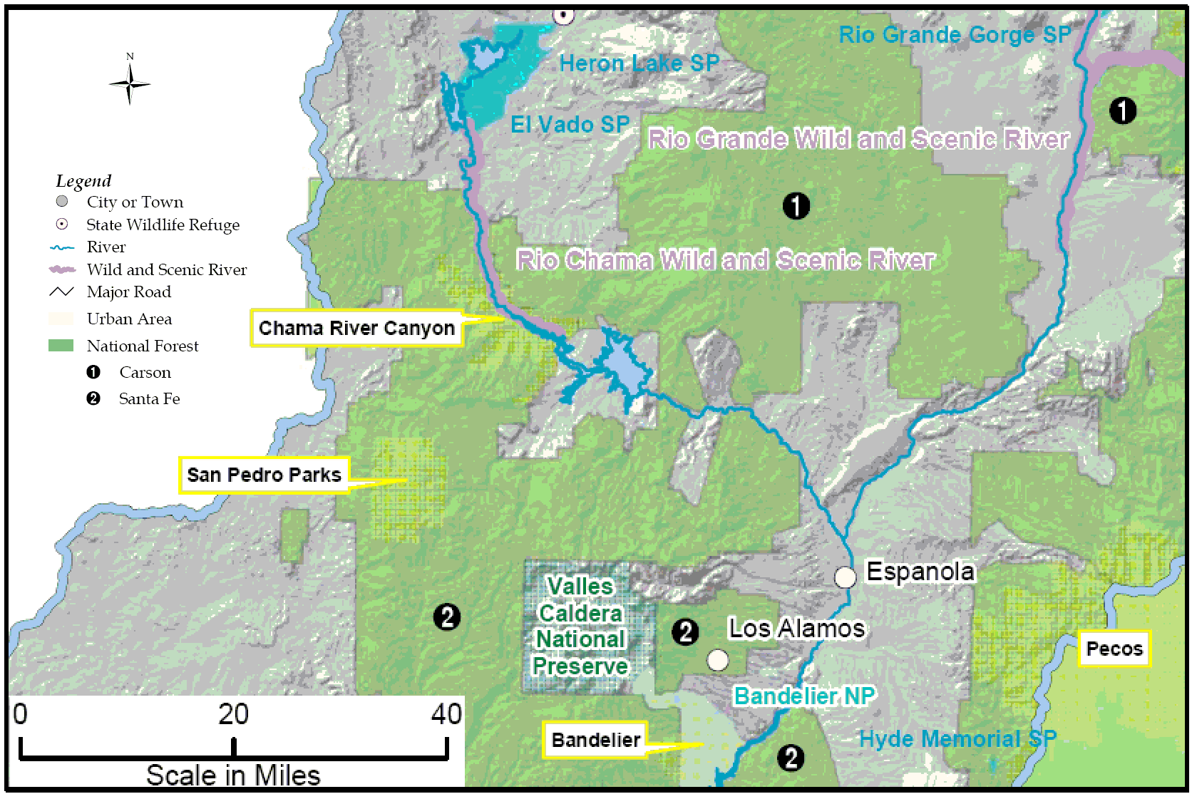
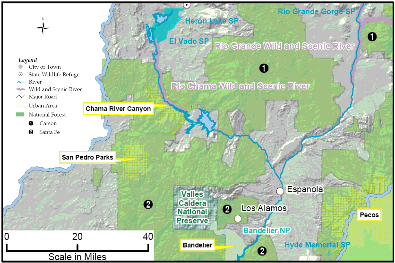
| Description | Map of Rio Chama, New Mexico, and portion of Rio Grande in New Mexico |
| Date | |
| Source | US Army Corps of Engineers (Albuquerque District), Upper Rio Grande Basin, Water Operations Review, Final Environmental Impact Statement (FES-07-05), Vol. 1, Ch. 3, p. 60, modified by uploader |
| Author | US Army Corps of Engineers |
| Permission (Reusing this file) |
Public Domain |
Licensing edit
This file is a work of a U.S. Army soldier or employee, taken or made as part of that person's official duties. As a work of the U.S. federal government, it is in the public domain in the United States.
|
 |
File history
Click on a date/time to view the file as it appeared at that time.
| Date/Time | Thumbnail | Dimensions | User | Comment | |
|---|---|---|---|---|---|
| current | 16:29, 24 April 2007 | | 1,672 × 1,114 (116 KB) | Bejnar (talk | contribs) | {{Information |Description=Map of Rio Chama, New Mexico, and portion of Rio Grande in New Mexico |Source= US Army Corps of Engineers (Albuquerque District), Upper Rio Grande Basin, Water Operations Review, Final Environmental Impact Statement (FES-07-05), |
You cannot overwrite this file.
File usage on Commons
There are no pages that use this file.
File usage on other wikis
The following other wikis use this file:
- Usage on en.wikipedia.org