File:Rio Negro meanders retusche.jpg

Size of this preview: 701 × 599 pixels. Other resolutions: 281 × 240 pixels | 562 × 480 pixels | 899 × 768 pixels | 1,198 × 1,024 pixels | 2,396 × 2,048 pixels | 3,332 × 2,848 pixels.
Original file (3,332 × 2,848 pixels, file size: 4.8 MB, MIME type: image/jpeg)
Captions
Captions
Add a one-line explanation of what this file represents
| Description |
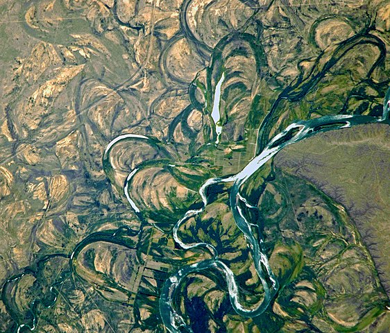
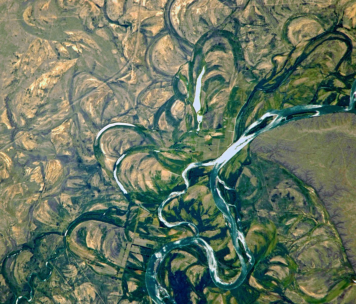
English: Country or Geographic Name: ARGENTINA
Features: RIO NEGRO, COLONEL JOSEFA AREA, FLOOD PLAIN Center Point Latitude: -39.8 Center Point Longitude: -65.4 |
|||||
| Date | Date: 20100104 (YYYYMMDD)GMT Time: 175502 (HHMMSS) | |||||
| Source | ftp://eol.jsc.nasa.gov/EFS_highres_ISS022_ISS022-E-19513.JPG via http://climate.nasa.gov/blogs/index.cfm?FuseAction=ShowBlog&NewsID=462 | |||||
| Author | NASA Astronaut photograph ISS022-E-19513, derivative work Lämpel | |||||
| Permission (Reusing this file) |
|
|||||
| Other versions | See http://eol.jsc.nasa.gov/scripts/sseop/photo.pl?mission=ISS022&roll=E&frame=19513 |

| This is a retouched picture, which means that it has been digitally altered from its original version. Modifications: Farbe und Kontrast optimiert, Crop. The original can be viewed here: Rio Negro meanders.JPG:
|
File history
Click on a date/time to view the file as it appeared at that time.
| Date/Time | Thumbnail | Dimensions | User | Comment | |
|---|---|---|---|---|---|
| current | 10:15, 8 January 2018 | | 3,332 × 2,848 (4.8 MB) | Lämpel (talk | contribs) | {{Information |Description ={{en|1=Country or Geographic Name: ARGENTINA Features: RIO NEGRO, COLONEL JOSEFA AREA, FLOOD PLAIN Center Point Latitude: -39.8 Center Point Longitude: -65.4 }} |Source =ftp://eol.jsc.nasa.gov/EFS_highres_ISS022_I... |
You cannot overwrite this file.
File usage on Commons
The following page uses this file:
File usage on other wikis
The following other wikis use this file:
- Usage on de.wikipedia.org
- Usage on lb.wikipedia.org
- Usage on lt.wikipedia.org