File:River mouth of old edogawa in 1945.jpg

Size of this preview: 600 × 600 pixels. Other resolutions: 240 × 240 pixels | 480 × 480 pixels | 768 × 768 pixels | 1,024 × 1,024 pixels.
Original file (1,024 × 1,024 pixels, file size: 841 KB, MIME type: image/jpeg)
Captions
Captions
Add a one-line explanation of what this file represents
Summary edit
| Description |
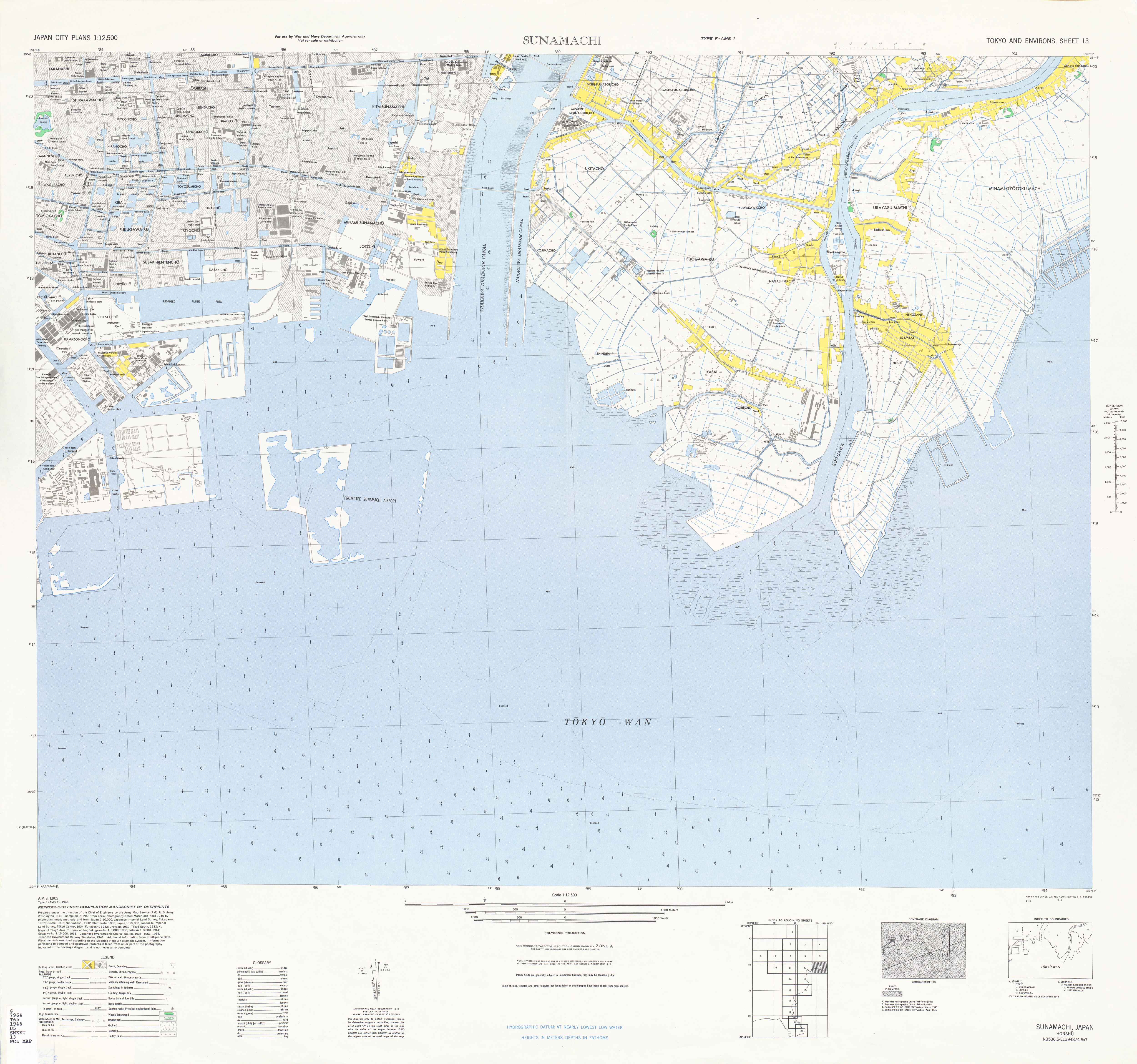
English: This map shows the river mouth of old Edogawa between Tokyo and Chiba prefecture in 1945. Dai sankaku, Kami sijimi jima, Simo sijimi jima had been filled since 1972.
日本語: 1945年頃の旧江戸川の河口を示した図。大三角、上蜆島、下蜆島は1972年頃に埋め立てられた。 |
| Date | |
| Source | |
| Author | US army, Nagasima Sakon |
Licensing edit
This work is in the public domain in the United States because it is a work prepared by an officer or employee of the United States Government as part of that person’s official duties under the terms of Title 17, Chapter 1, Section 105 of the US Code.
Note: This only applies to original works of the Federal Government and not to the work of any individual U.S. state, territory, commonwealth, county, municipality, or any other subdivision. This template also does not apply to postage stamp designs published by the United States Postal Service since 1978. (See § 313.6(C)(1) of Compendium of U.S. Copyright Office Practices). It also does not apply to certain US coins; see The US Mint Terms of Use.
|
 | |
| This file has been identified as being free of known restrictions under copyright law, including all related and neighboring rights. | ||
File history
Click on a date/time to view the file as it appeared at that time.
| Date/Time | Thumbnail | Dimensions | User | Comment | |
|---|---|---|---|---|---|
| current | 06:15, 22 March 2010 | | 1,024 × 1,024 (841 KB) | 長島左近 (talk | contribs) | {{Information |Description={{en|1=This map shows the river mouth of old Edogawa between Tokyo and Chiba prefecture in 1945. Dai sankaku, Kami sijimi jima, Simo sijimi jima had been filled in 1972.}} {{ja|1=1945年頃の旧江戸川の河口を示した図 |
You cannot overwrite this file.
File usage on Commons
There are no pages that use this file.