File:Road junction, Dursley town centre - geograph.org.uk - 103717.jpg

Size of this preview: 790 × 600 pixels. Other resolutions: 316 × 240 pixels | 632 × 480 pixels | 1,012 × 768 pixels | 1,280 × 972 pixels | 1,632 × 1,239 pixels.
Original file (1,632 × 1,239 pixels, file size: 1.2 MB, MIME type: image/jpeg)
Captions
Captions
Add a one-line explanation of what this file represents
Summary edit
| Description |
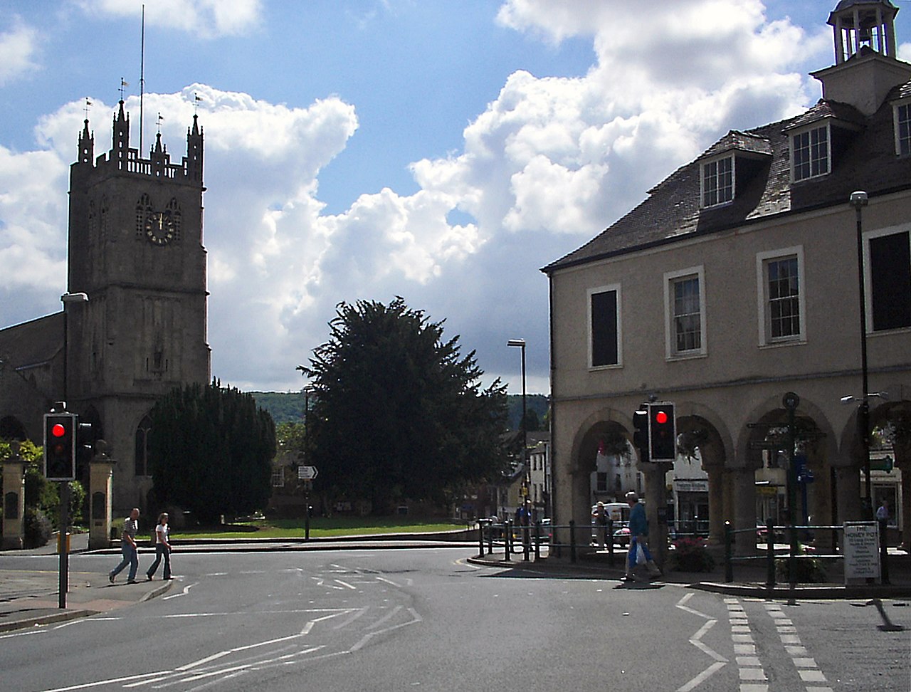
English: Road junction, Dursley town centre. The junction of Long Street / Castle Street / Silver Street / Parsonage Street in the centre of the town. The market Hall on the right dates from 1738, and was paid for by the Escourt family. The parish church on the left is dedicated to St. James. |
| Date | |
| Source | From geograph.org.uk |
| Author | Phil Champion |
| Attribution (required by the license) | Phil Champion / Road junction, Dursley town centre / |
| Object location | | View this and other nearby images on: OpenStreetMap |
|---|
_&language=en)
Licensing edit

|
This image was taken from the Geograph project collection. See this photograph's page on the Geograph website for the photographer's contact details. The copyright on this image is owned by Phil Champion and is licensed for reuse under the Creative Commons Attribution-ShareAlike 2.0 license.
|
This file is licensed under the Creative Commons Attribution-Share Alike 2.0 Generic license.
Attribution: Phil Champion
- You are free:
- to share – to copy, distribute and transmit the work
- to remix – to adapt the work
- Under the following conditions:
- attribution – You must give appropriate credit, provide a link to the license, and indicate if changes were made. You may do so in any reasonable manner, but not in any way that suggests the licensor endorses you or your use.
- share alike – If you remix, transform, or build upon the material, you must distribute your contributions under the same or compatible license as the original.
File history
Click on a date/time to view the file as it appeared at that time.
| Date/Time | Thumbnail | Dimensions | User | Comment | |
|---|---|---|---|---|---|
| current | 01:01, 22 July 2021 | | 1,632 × 1,239 (1.2 MB) | Geograph Update Bot (talk | contribs) | Higher-resolution version from Geograph |
| 01:28, 31 January 2010 |  | 640 × 486 (109 KB) | GeographBot (talk | contribs) | == {{int:filedesc}} == {{Information |description={{en|1=Road junction, Dursley town centre. The junction of Long Street / Castle Street / Silver Street / Parsonage Street in the centre of the town. The market Hall on the right dates from 1738, and was pa |
You cannot overwrite this file.
File usage on Commons
There are no pages that use this file.
File usage on other wikis
The following other wikis use this file: