File:Robert C. Beauchamp Farm.jpg

Size of this preview: 800 × 450 pixels. Other resolutions: 320 × 180 pixels | 640 × 360 pixels | 1,024 × 576 pixels | 1,280 × 720 pixels | 2,816 × 1,584 pixels.
Original file (2,816 × 1,584 pixels, file size: 1.11 MB, MIME type: image/jpeg)
Captions
Captions
Add a one-line explanation of what this file represents
|
This is an image of a place or building that is listed on the National Register of Historic Places in the United States of America. Its reference number is 76000894. |
| Camera location | | View this and other nearby images on: OpenStreetMap |
|---|
| Description |
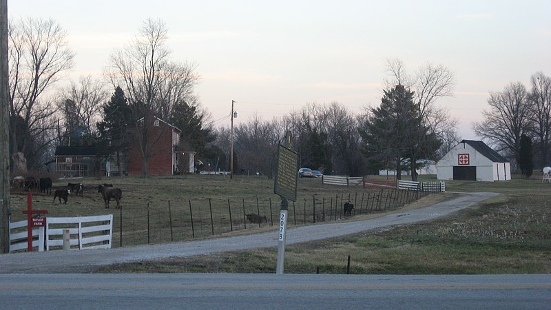
English: View from the west of the Robert C. Beauchamp House and associated farm buildings, located at the junction of U.S. Route 60 and Kentucky Route 3543 northwest of Hawesville in Hancock County, Kentucky, United States. Built in 1842, the house is listed on the National Register of Historic Places. |
||
| Date | Taken on 6 February 2013 | ||
| Source | Own work | ||
| Author | Nyttend | ||
| Permission (Reusing this file) |
|
File history
Click on a date/time to view the file as it appeared at that time.
| Date/Time | Thumbnail | Dimensions | User | Comment | |
|---|---|---|---|---|---|
| current | 15:57, 9 February 2013 | | 2,816 × 1,584 (1.11 MB) | Nyttend (talk | contribs) | {{NRHP|76000894}} {{Location|37|55|28|N|86|48|22|W}} {{Information |Description={{en|View from the west of the {{w|Robert C. Beauchamp House}} and associated farm buildings, located at the junction of {{w|U.S. Route 60}} and {{w|Kentucky Route 3543}} n... |
You cannot overwrite this file.
File usage on Commons
There are no pages that use this file.
File usage on other wikis
The following other wikis use this file:
- Usage on en.wikipedia.org
- Usage on www.wikidata.org