File:Robinia pseudoacacia range map.jpg
Size of this preview: 463 × 600 pixels. Other resolutions: 185 × 240 pixels | 556 × 720 pixels.
Original file (556 × 720 pixels, file size: 61 KB, MIME type: image/jpeg)
Captions
Captions
Add a one-line explanation of what this file represents

|
This map image could be re-created using vector graphics as an SVG file. This has several advantages; see Commons:Media for cleanup for more information. If an SVG form of this image is available, please upload it and afterwards replace this template with
{{vector version available|new image name}}.
It is recommended to name the SVG file “Robinia pseudoacacia range map.svg”—then the template Vector version available (or Vva) does not need the new image name parameter. |

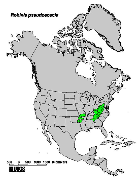
| Description | Range map of Robinia pseudoacacia | |||
| Date | ||||
| Source | Digital representation of "Atlas of United States Trees" by Elbert L. Little, Jr. [1][dead link] | |||
| Author | U.S. Geological Survey | |||
| Permission (Reusing this file) |
|
File history
Click on a date/time to view the file as it appeared at that time.
| Date/Time | Thumbnail | Dimensions | User | Comment | |
|---|---|---|---|---|---|
| current | 09:35, 9 October 2011 | | 556 × 720 (61 KB) | Forstbirdo (talk | contribs) | {{Information |Description=Range map of Robinia pseudoacacia |Source=Digital representation of "Atlas of United States Trees" by Elbert L. Little, Jr. [http://esp.cr.usgs.gov/data/atlas/little/] |Date=1999 |Author=U.S. Geological Survey |Permission={{PD-U |
You cannot overwrite this file.
File usage on Commons
There are no pages that use this file.
File usage on other wikis
The following other wikis use this file:
- Usage on be.wikipedia.org
- Usage on el.wikipedia.org
- Usage on eo.wikipedia.org
- Usage on fa.wikipedia.org
- Usage on hu.wikipedia.org
- Usage on lt.wikipedia.org
- Usage on pt.wikipedia.org
- Usage on ro.wikipedia.org
- Usage on ru.wikipedia.org
- Usage on tg.wikipedia.org