File:Rockfish Gap November 2009.jpg

Size of this preview: 800 × 450 pixels. Other resolutions: 320 × 180 pixels | 640 × 360 pixels | 1,024 × 576 pixels | 1,280 × 720 pixels | 2,560 × 1,440 pixels | 3,648 × 2,052 pixels.
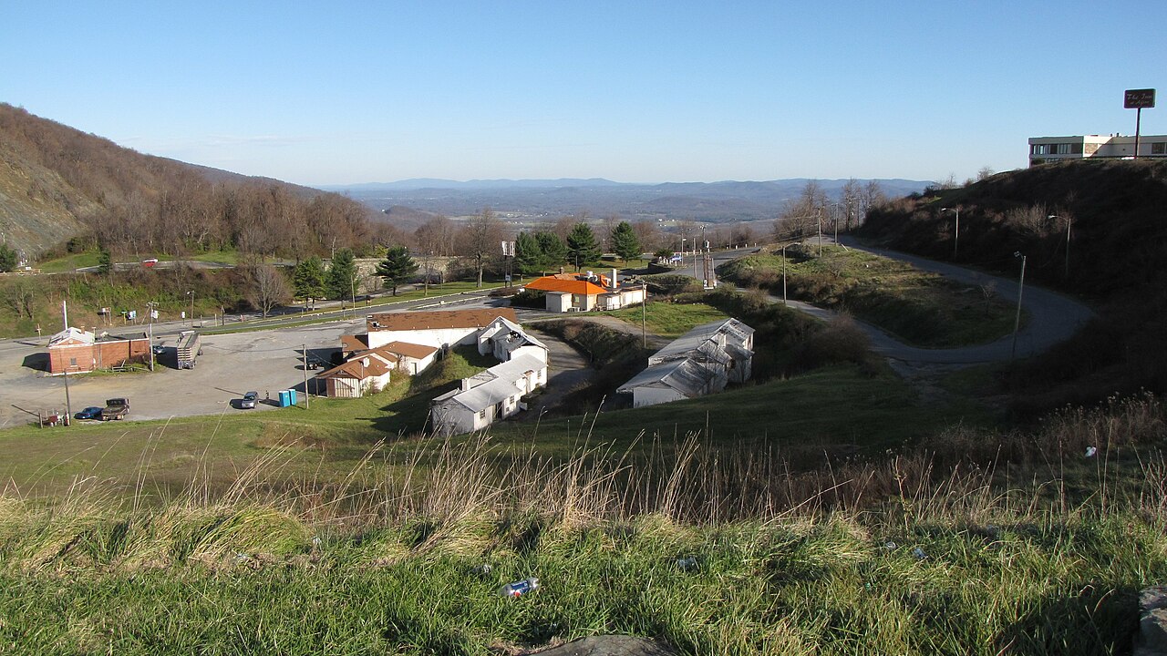
Original file (3,648 × 2,052 pixels, file size: 1.43 MB, MIME type: image/jpeg)
Captions
Captions
Add a one-line explanation of what this file represents
Summary edit
| Description | |
| Date | |
| Source | Own work |
| Author | Ben Schumin |
| Permission (Reusing this file) |
Own work |
| Camera location | | View this and other nearby images on: OpenStreetMap |
|---|
Licensing edit
This file is licensed under the Creative Commons Attribution-Share Alike 3.0 Unported license.
- You are free:
- to share – to copy, distribute and transmit the work
- to remix – to adapt the work
- Under the following conditions:
- attribution – You must give appropriate credit, provide a link to the license, and indicate if changes were made. You may do so in any reasonable manner, but not in any way that suggests the licensor endorses you or your use.
- share alike – If you remix, transform, or build upon the material, you must distribute your contributions under the same or compatible license as the original.
File history
Click on a date/time to view the file as it appeared at that time.
| Date/Time | Thumbnail | Dimensions | User | Comment | |
|---|---|---|---|---|---|
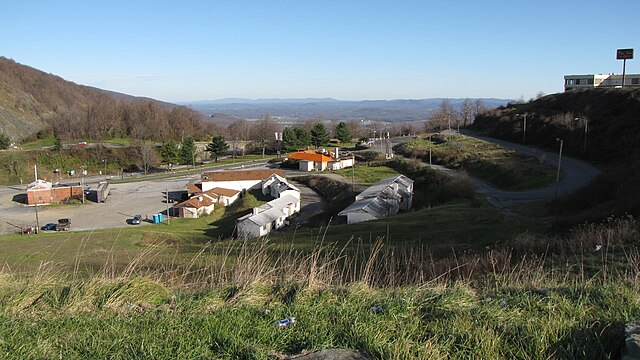
| current | 04:12, 30 November 2009 | | 3,648 × 2,052 (1.43 MB) | SchuminWeb (talk | contribs) | {{Information |Description={{en|1=Rockfish Gap, showing the nearby cluster of businesses.}} |Source=Own work |Author=Ben Schumin |Date=2009-11-29 |Permission=Own work |other_versions= }} {{Location|38|1|48.8|N|78|51|29.3|W}} [[Category:Augusta County, Vir |
You cannot overwrite this file.
File usage on Commons
There are no pages that use this file.
File usage on other wikis
The following other wikis use this file: