File:Roma - mappa linee FL.svg

Size of this PNG preview of this SVG file: 774 × 600 pixels. Other resolutions: 310 × 240 pixels | 619 × 480 pixels | 991 × 768 pixels | 1,280 × 992 pixels | 2,560 × 1,984 pixels | 1,921 × 1,489 pixels.
Original file (SVG file, nominally 1,921 × 1,489 pixels, file size: 1.52 MB)
Captions
Captions
Add a one-line explanation of what this file represents
Summary edit
| Description |
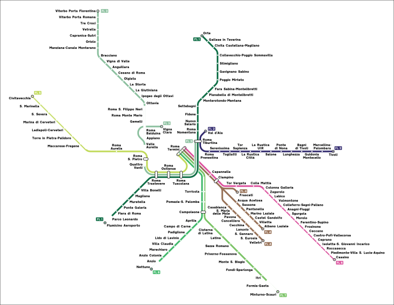
Italiano: Mappa delle linee FL di Roma. |
| Source | Own work |
| Author | Arbalete |
| Permission (Reusing this file) |
I, the copyright holder of this work, hereby publish it under the following license: This file is licensed under the Creative Commons Attribution-Share Alike 4.0 International license.
|
File history
Click on a date/time to view the file as it appeared at that time.
| Date/Time | Thumbnail | Dimensions | User | Comment | |
|---|---|---|---|---|---|
| current | 11:26, 26 June 2023 | | 1,921 × 1,489 (1.52 MB) | Arbalete (talk | contribs) | Aggiorno |
| 15:50, 4 April 2016 |  | 1,693 × 1,378 (1.4 MB) | Arbalete (talk | contribs) | Piccola correzione | |
| 22:16, 3 April 2016 |  | 1,693 × 1,378 (1.39 MB) | Arbalete (talk | contribs) | Aggiunta la stazione di Ponte di Nona in servizio dal 4.4.2016. | |
| 06:47, 18 February 2016 |  | 1,693 × 1,378 (1.39 MB) | Arbalete (talk | contribs) | Piccola correzione | |
| 00:19, 18 February 2016 |  | 1,693 × 1,378 (1.39 MB) | Arbalete (talk | contribs) | Aggiungo confine comunale | |
| 20:22, 12 February 2016 |  | 1,693 × 1,378 (1.39 MB) | Arbalete (talk | contribs) | User created page with UploadWizard |
You cannot overwrite this file.
File usage on Commons
The following 13 pages use this file:
- User:Arbalete/Maps
- User:Chumwa/OgreBot/Potential transport maps/2016 April 1-10
- User:Chumwa/OgreBot/Potential transport maps/2016 February 10-19
- User:Chumwa/OgreBot/Public transport information/2016 April 1-10
- User:Chumwa/OgreBot/Public transport information/2016 February 10-19
- User:Chumwa/OgreBot/Public transport information/2023 June 21-30
- User:Chumwa/OgreBot/Transport Maps/2016 April 1-10
- User:Chumwa/OgreBot/Transport Maps/2016 February 10-19
- User:Chumwa/OgreBot/Transport Maps/2023 June 21-30
- User:Chumwa/OgreBot/Travel and communication maps/2016 April 1-10
- User:Chumwa/OgreBot/Travel and communication maps/2016 February 10-19
- User talk:Arbalete
- Category:Ferrovie Laziali
File usage on other wikis
The following other wikis use this file:
- Usage on de.wikipedia.org
- Usage on de.wikivoyage.org
- Usage on en.wikipedia.org
- Usage on es.wikipedia.org
- Usage on fr.wikipedia.org
- Ligne ferroviaire régionale du Latium FL3
- Service ferroviaire suburbain de Rome
- Ligne ferroviaire régionale du Latium FL2
- Ligne ferroviaire régionale du Latium FL4
- Ligne ferroviaire régionale du Latium FL5
- Ligne ferroviaire régionale du Latium FL6
- Ligne ferroviaire régionale du Latium FL7
- Ligne ferroviaire régionale du Latium FL8
- Usage on it.wikipedia.org
- Usage on it.wikivoyage.org
- Usage on ja.wikipedia.org
- Usage on ko.wikipedia.org
- Usage on lmo.wikipedia.org
- Usage on nl.wikivoyage.org
- Usage on sv.wikipedia.org
- Usage on www.wikidata.org