File:SO LXXV 45 Waldburg Oberamt Ravensburg Württembergische Landesvermessung (1825) Landesarchiv BW EL 68 VI Nr 13989 Bild 1 (2-5325309-1).png

Size of this preview: 626 × 599 pixels. Other resolutions: 251 × 240 pixels | 502 × 480 pixels | 803 × 768 pixels | 1,070 × 1,024 pixels | 2,161 × 2,068 pixels.
Original file (2,161 × 2,068 pixels, file size: 2.74 MB, MIME type: image/png)
Captions
Captions
Add a one-line explanation of what this file represents
Summary edit
_Landesarchiv_BW_EL_68_VI_Nr_13989_Bild_1_(2-5325309-1).png&action=edit§ion=1)
Index der Kartensignaturen:
- Alt-Signatur: Blatt S. O. LXXV. 45.
- Rahmengitter: SO07545 ist gleichzeitig Sortierschlüssel für Category:Württembergische Flurkarte 1:2.500
- Teilbereich: Nr. in :File:Topographischer Atlas des Koenigreichs Württemberg - Blatt
| Description |
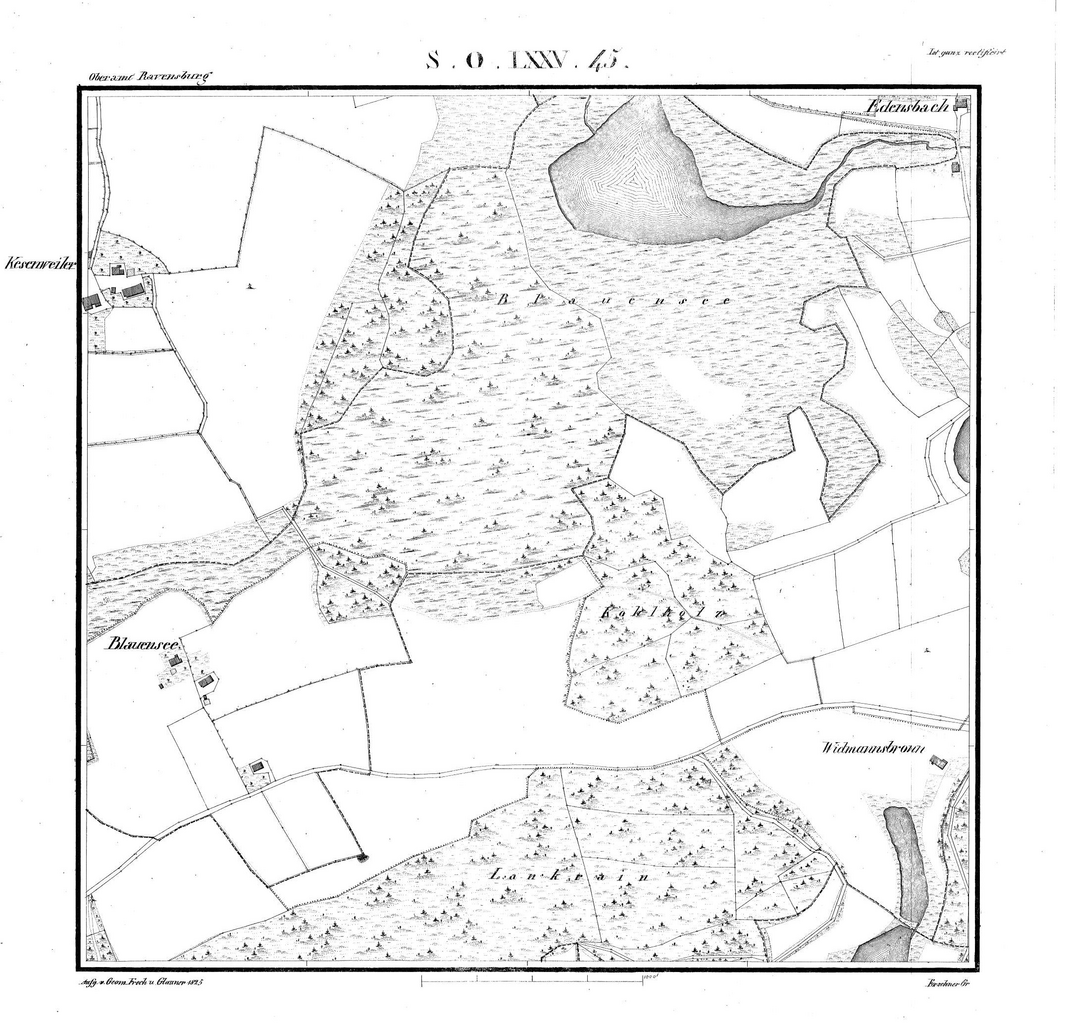
Deutsch: Waldburg, südöstlich der eigentlichen Burg mit Edensbach, Kesenweiler, Blauensee und Widmannsbronn auf der Urflurkarte von 1825, Blatt S. O. LXXV. 45. |
| Date | |
| Source | Landesarchiv BW Permalink: http://www.landesarchiv-bw.de/plink/?f=2-5325309-1 |
| Author | Statistisch-Topographisches Bureau des Königreichs Württemberg |
| Object location | | View this and other nearby images on: OpenStreetMap |
|---|
_Landesarchiv_BW_EL_68_VI_Nr_13989_Bild_1_(2-5325309-1).png¶ms=047.752500_N_0009.728700_E_globe:Earth_class:object_type:object_region:DE-BW_&language=en)
(ca. Kartenmitte)
|
This work is in the public domain in its country of origin and other countries and areas where the copyright term is the author's life plus 100 years or fewer. | |
| This file has been identified as being free of known restrictions under copyright law, including all related and neighboring rights. | |
File history
Click on a date/time to view the file as it appeared at that time.
| Date/Time | Thumbnail | Dimensions | User | Comment | |
|---|---|---|---|---|---|
| current | 00:43, 8 October 2023 | | 2,161 × 2,068 (2.74 MB) | Tom (talk | contribs) | {{Information |Description ={{de|1=Waldburg, südöstlich der eigentlichen Burg mit Edensbach, Kesenweiler, Blauensee und Widmannsbronn auf der Urflurkarte von 1825, Blatt S. O. LXXV. 45.}} |Source =Landesarchiv BW Permalink: http://www.landesarchiv-bw.de/plink/?f=2-5303600-1 |Author =Statistisch-Topographisches Bureau des Königreichs Württemberg |Date =1832 |Permission = |other_versions = |Other fields = Index der Kartensignaturen: * Alt-Signatur: Blatt S.... |
You cannot overwrite this file.
File usage on Commons
The following page uses this file:
File usage on other wikis
The following other wikis use this file:
- Usage on de.wikisource.org
_Landesarchiv_BW_EL_68_VI_Nr_13989_Bild_1_(2-5325309-1).png&oldid=810843410)