File:STC Paul 16 apr 2000 0931Z.jpg
Size of this preview: 600 × 600 pixels. Other resolutions: 240 × 240 pixels | 480 × 480 pixels | 904 × 904 pixels.
Original file (904 × 904 pixels, file size: 218 KB, MIME type: image/jpeg)
Captions
Captions
Add a one-line explanation of what this file represents
Summary edit
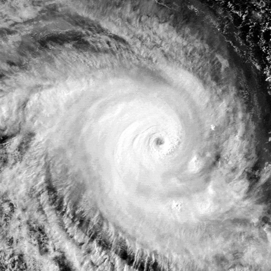
| Description | This image was captured by the GMS-5 satellite on April 16, 2000 at 0931 UTC. Paul was located in the Indian Ocean with maximum sustained winds of 110 knots (10-minute average) and a minimum pressure of 920 mb. | ||||||
| Date | |||||||
| Source | http://www.nrlmry.navy.mil/tc_pages/tc_home.html | ||||||
| Author | Naval Research Laboratory | ||||||
| Permission (Reusing this file) |
|
||||||

File history
Click on a date/time to view the file as it appeared at that time.
| Date/Time | Thumbnail | Dimensions | User | Comment | |
|---|---|---|---|---|---|
| current | 23:21, 27 March 2010 | | 904 × 904 (218 KB) | Supportstorm (talk | contribs) | Removed Lines/ Contrast Correction |
| 19:30, 8 October 2006 |  | 904 × 904 (202 KB) | Good kitty (talk | contribs) | == Summary == {{Information |Description=This image was captured by the GMS-5 satellite on April 16, 2000 at 0931 UTC. Paul was located in the Indian Ocean with maximum sustained winds of 110 knots (10-minute average) and a minimum pressure of 920 mb. |So |
You cannot overwrite this file.
File usage on Commons
There are no pages that use this file.