File:Sacramento-San Joaquin Delta OSM Transport.png

Original file (1,370 × 897 pixels, file size: 678 KB, MIME type: image/png)
Captions
Captions
Summary edit
| Description |
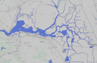
English: It's a map. |
| Date | |
| Source | OpenStreetMap "Transport" layer |
| Author | OpenStreetMap contributors |
| Permission (Reusing this file) |
This file is licensed under the Creative Commons Attribution 2.0 Generic license.
|
Taken from OpenStreetMap to use as a location map. Boundaries of the map are, from OSM:
West extent: Node: Redwood Valley Railway (962970412) 37°52′50″N 122°13′23″W / 37.8805370°N 122.2230248°W
South extent: Node: 3959842714 East Louise Ave 37°48′43″N 121°17′26″W / 37.8118352°N 121.2905058°W
East extent: Node: Stockton–San Joaquin Street (6120572341) Version #6 · Changeset #88054694 37°56′43″N 121°17′08″W / 37.9452819°N 121.2855571°W
Top extent: Way: Manuel Campos Parkway (47386736) Node: 603229813 Edited 9 months ago by diggernet Version #7 · Changeset #78116095 38°17′43″N 122°02′04″W / 38.2953858°N 122.0345076°W
[{Category:Maps of California]}}}}
File history
Click on a date/time to view the file as it appeared at that time.
| Date/Time | Thumbnail | Dimensions | User | Comment | |
|---|---|---|---|---|---|
| current | 00:13, 26 February 2021 | | 1,370 × 897 (678 KB) | JPxG (talk | contribs) | Overlay of 50% gray at 50% opacity to make it, perhaps, look less horrifying on the template |
| 00:43, 18 September 2020 |  | 1,370 × 897 (731 KB) | JPxG (talk | contribs) | Highlight a few rivers that got missed somehow | |
| 22:31, 17 September 2020 |  | 1,370 × 897 (722 KB) | JPxG (talk | contribs) | Add some extra outline on the water so it shows up better at low res. Also the water should be blue and not indigo or whatever claptrap it was before. | |
| 22:21, 17 September 2020 |  | 1,370 × 897 (647 KB) | JPxG (talk | contribs) | Made roads more visible as well. | |
| 22:19, 17 September 2020 |  | 1,370 × 897 (628 KB) | JPxG (talk | contribs) | Changing water hue and brightness, as well as making it a bit more visible in general. | |
| 22:01, 17 September 2020 |  | 1,370 × 897 (557 KB) | JPxG (talk | contribs) | {{Information |description ={{en|1=It's a map.}} |date =2020-09-16 |source =OpenStreetMap "Transport" layer |author =OpenStreetMap contributors |permission ={{cc-by-2.0}} }} Taken from OpenStreetMap to use as a location map. Boundaries of the map are, from OSM: West extent: Node: Redwood Valley Railway (962970412) {{location|37.8805370|-122.2230248}} South extent: Node: 3959842714 East Louise Ave {{location|37.8118352|-121.2905058 {{location| East extent: Node:... |
You cannot overwrite this file.
File usage on Commons
There are no pages that use this file.