File:Salish Sea (MODIS 2021-06-03).jpg

Original file (2,225 × 1,807 pixels, file size: 535 KB, MIME type: image/jpeg)
Captions
Captions
Summary edit
.jpg&action=edit§ion=1)
| Description |
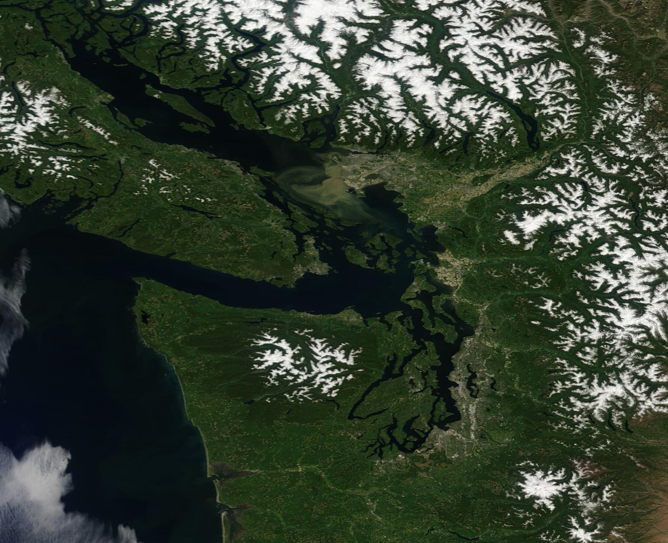
English: The afternoon of June 1, 2021, was bright and sunny over the Pacific Northwest, allowing the Moderate Resolution Imaging Spectroradiometer (MODIS) on board NASA’s Terra satellite to acquire a gorgeous true-color image of the Salish Sea, Canada (north), and the United States (south).
The blue waters of the southern Salish Sea separate Vancouver Island, Canada from the Olympic Peninsula of the United States. The Salish Sea includes an intricate network of connecting channels and adjoining waterways, including the Strait of Georgia, Strait of Juan de Fuca, and Puget Sound, which primarily lie in southwest British Columbia, Canada. Named for the Salish indigenous people who live along the British Columbia and Washington state (United States) coastline, these waters form an extensive estuary system which is extremely rich in biodiversity and is vital to the welfare of many millions of people who live in the region. Just above the center of the image, a large brown stain can be seen between Vancouver Island and the coast of the mainland. This is the outflow of the Fraser River, which drains roughly one-quarter the British Columbia as it winds roughly 850 miles to reach Georgia Strait. The brown stain comes from sediment and silt released along with fresh water into the saline Strait from the Fraser. The Fraser River has gained fame as the river with the largest salmon runs in North America. |
||
| Date | Taken on 1 June 2021 | ||
| Source |
|
||
| Author | MODIS Land Rapid Response Team, NASA GSFC |
| This media is a product of the Terra mission Credit and attribution belongs to the mission team, if not already specified in the "author" row |
Licensing edit
.jpg&action=edit§ion=2)
| This file is in the public domain in the United States because it was solely created by NASA. NASA copyright policy states that "NASA material is not protected by copyright unless noted". (See Template:PD-USGov, NASA copyright policy page or JPL Image Use Policy.) | ||
 |
Warnings:
|
File history
Click on a date/time to view the file as it appeared at that time.
| Date/Time | Thumbnail | Dimensions | User | Comment | |
|---|---|---|---|---|---|
| current | 17:44, 30 January 2024 | | 2,225 × 1,807 (535 KB) | OptimusPrimeBot (talk | contribs) | #Spacemedia - Upload of http://modis.gsfc.nasa.gov/gallery/images/image06032021_250m.jpg via Commons:Spacemedia |
You cannot overwrite this file.
File usage on Commons
There are no pages that use this file.
.jpg&oldid=847270908)