File:SanAndreasHighlandWay.jpg
No higher resolution available.
SanAndreasHighlandWay.jpg (708 × 498 pixels, file size: 171 KB, MIME type: image/jpeg)
Captions
Captions
Add a one-line explanation of what this file represents
Summary edit
| Description |
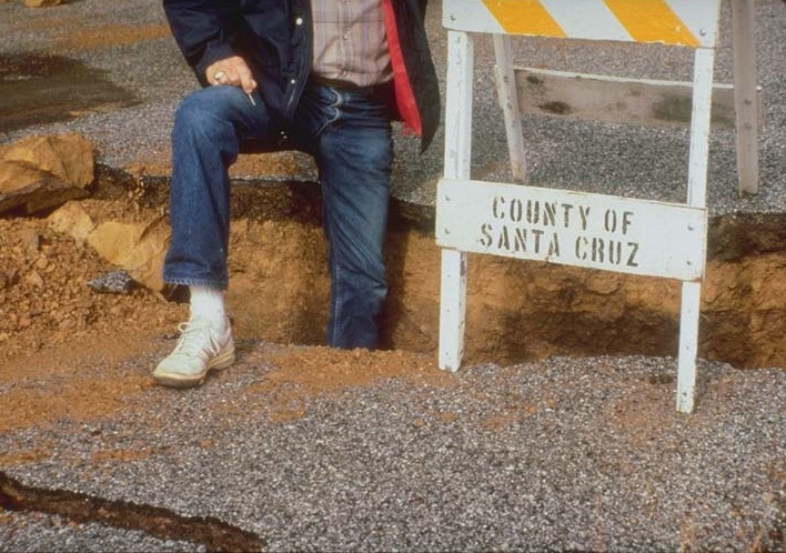
English: Photo shows depth of fissures on the San Andreas Highland Way approximately 3.2 km southeast of Loma Prieta in the Santa Cruz mountains. |
| Date | |
| Source | http://ngdc.noaa.gov/hazardimages/picture/show/250 |
| Author | C. Stover. U.S. Geological Survey |
Licensing edit
This image is in the public domain in the United States because it only contains materials that originally came from the United States Geological Survey, an agency of the United States Department of the Interior. For more information, see the official USGS copyright policy.
|
File history
Click on a date/time to view the file as it appeared at that time.
| Date/Time | Thumbnail | Dimensions | User | Comment | |
|---|---|---|---|---|---|
| current | 15:18, 18 March 2015 | | 708 × 498 (171 KB) | たいすけ55 (talk | contribs) | User created page with UploadWizard |
You cannot overwrite this file.
File usage on Commons
There are no pages that use this file.