File:Sant Llorernç nevat- Vallès Occidental.jpg
Size of this preview: 750 × 600 pixels. Other resolutions: 300 × 240 pixels | 600 × 480 pixels | 960 × 768 pixels | 1,280 × 1,024 pixels.
Original file (1,280 × 1,024 pixels, file size: 347 KB, MIME type: image/jpeg)
Captions
Captions
Add a one-line explanation of what this file represents
Summary edit
| Description |
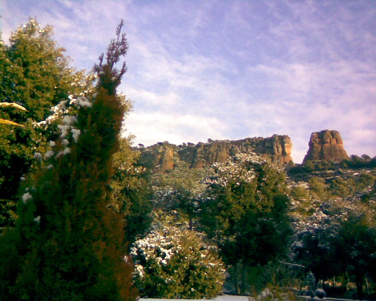
Català: Sant Llorenç del Munt nevat. Vist des de Matadepera, a la dreta destaca el Cavall Bernat, ver l'esquerra i fora de la imatge hi ha el cim de la Mola, el més elevat del Vallès Occidental. |
| Date | Winter 2008 |
| Source | Del meu arxiu personal. |
| Author | Jo , Boti65 |
Licensing edit
| I, the copyright holder of this work, release this work into the public domain. This applies worldwide. In some countries this may not be legally possible; if so: I grant anyone the right to use this work for any purpose, without any conditions, unless such conditions are required by law. |
File history
Click on a date/time to view the file as it appeared at that time.
| Date/Time | Thumbnail | Dimensions | User | Comment | |
|---|---|---|---|---|---|
| current | 15:37, 31 July 2009 | | 1,280 × 1,024 (347 KB) | Boti65 (talk | contribs) | {{Information |Description={{ca|1=Cims de Sant Llorenç, pic de la Mola, nevat. Vist des de Matadepera. El més elevat del Vallès Occidental.}} |Source=Del meu arxiu personal. |Author=Jo , Boti65 |Date=Hivern 2008 |Permission= |other_versions= }} [[Cate |
| 15:36, 31 July 2009 |  | 1,280 × 1,024 (347 KB) | Boti65 (talk | contribs) | {{Information |Description={{ca|1=Cims de Sant Llorenç, pic de la Mola, nevat. Vist des de Matadepera. El més elevat del Vallès Occidental.}} |Source=Del meu arxiu personal. |Author=Jo , Boti65 |Date=Hivern 2008 |Permission= |other_versions= }} [[Cate |
You cannot overwrite this file.
File usage on Commons
The following 8 pages use this file:
- Category:Archaeological sites in Vallès Occidental
- Category:Bridges in Vallès Occidental
- Category:Maps of Vallès Occidental
- Category:Mayors of Vallès Occidental
- Category:People of Vallès Occidental
- Category:Populated places in Vallès Occidental
- Category:Vallès Occidental
- Category:Views of Vallès Occidental
File usage on other wikis
The following other wikis use this file:
- Usage on ar.wikipedia.org
- Usage on ca.wikipedia.org
- Usage on diq.wikipedia.org
- Usage on es.wikipedia.org
- Usage on gl.wikipedia.org
- Usage on hu.wikipedia.org
- Usage on ku.wikipedia.org
- Usage on oc.wikipedia.org
- Usage on pt.wikipedia.org
- Usage on ro.wikipedia.org
- Usage on ru.wikipedia.org
- Usage on sr.wikipedia.org
- Usage on sv.wikipedia.org
- Usage on www.wikidata.org
- Usage on zh.wikipedia.org