File:Santa Cruz River, aerial (8f180f51-94ea-4aea-b09b-37c9baca191f).jpg
No higher resolution available.
Santa_Cruz_River,_aerial_(8f180f51-94ea-4aea-b09b-37c9baca191f).jpg (232 × 300 pixels, file size: 37 KB, MIME type: image/jpeg)
Captions
Captions
Add a one-line explanation of what this file represents

|
The categories of this image need checking. You can do so here.
|
.jpg&action=edit&withJS=MediaWiki:Catcheck.js)
Summary edit
.jpg&action=edit§ion=1)
| English: Santa Cruz River, aerial | ||||
|---|---|---|---|---|
| Photographer |
English: NPS Photo |
|||
| Title |
English: Santa Cruz River, aerial |
|||
| Description |
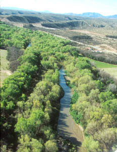
English: aerial photo of cottonwood-lined river corridor with river at center Santa Cruz River
|
|||
| Depicted place |
English: Tumacacori National Historical Park, Santa Cruz County, Arizona; Juan Bautista de Anza National Historic Trail |
|||
| Date | Taken on 6 April 2005 | |||
| Accession number | ||||
| Source |
English: NPGallery |
|||
| Permission (Reusing this file) |
|
|||
| Collector | English: NPS Photo |
|||
| NPS Unit Code | TUMA, JUBA | |||
| Album(s) | English: Santa Cruz River, Tumacácori AZ |
|||
File history
Click on a date/time to view the file as it appeared at that time.
| Date/Time | Thumbnail | Dimensions | User | Comment | |
|---|---|---|---|---|---|
| current | 20:12, 18 May 2021 | | 232 × 300 (37 KB) | BMacZeroBot (talk | contribs) | Batch upload (Commons:Batch uploading/NPGallery) |
You cannot overwrite this file.
File usage on Commons
The following page uses this file:
.jpg)
.jpg&oldid=622269896)