File:Sasinia na mapie adm. Polski.svg

Size of this PNG preview of this SVG file: 628 × 600 pixels. Other resolutions: 251 × 240 pixels | 503 × 480 pixels | 804 × 768 pixels | 1,072 × 1,024 pixels | 2,144 × 2,048 pixels | 5,935 × 5,669 pixels.
Original file (SVG file, nominally 5,935 × 5,669 pixels, file size: 2.37 MB)
Captions
Captions
Add a one-line explanation of what this file represents
Summary edit
| Description |
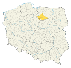
Polski: Sasinia na mapie administracyjnej Polski
English: Sasna on administrative map of Poland |
||
| Date | |||
| Source |
This W3C-unspecified vector image was created with Inkscape . |
||
| Author | JakaśKreatywnaNazwa123 | ||
| Permission (Reusing this file) |
|
||
| Other versions |
|


File history
Click on a date/time to view the file as it appeared at that time.
| Date/Time | Thumbnail | Dimensions | User | Comment | |
|---|---|---|---|---|---|
| current | 18:10, 2 September 2022 | | 5,935 × 5,669 (2.37 MB) | JakaśKreatywnaNazwa (talk | contribs) | Uploaded a work by JakaśKreatywnaNazwa123 from {{inkscape}} with UploadWizard |
You cannot overwrite this file.
File usage on Commons
There are no pages that use this file.
File usage on other wikis
The following other wikis use this file:
- Usage on pl.wikipedia.org