File:Sassanid-empire.gif
Sassanid-empire.gif (600 × 480 pixels, file size: 101 KB, MIME type: image/gif)
Captions
Captions
Summary edit
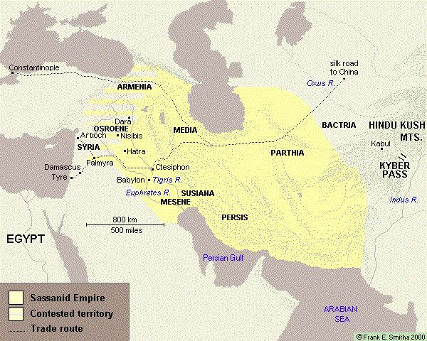
The normal borders of the great Sassanid Empire during much of its existence. (Map by Frank Smitha used by permission granted on December 15, 2006 by his agent, Marilynn Bell.)
Licensing edit

|
The copyright holder of this work allows anyone to use it for any purpose including unrestricted redistribution, commercial use, and modification.
Usage notes:
|
Atlas edit
This map should be added to the Wikimedia Atlas.
File history
Click on a date/time to view the file as it appeared at that time.
| Date/Time | Thumbnail | Dimensions | User | Comment | |
|---|---|---|---|---|---|
| current | 07:50, 14 June 2017 | | 600 × 480 (101 KB) | Babak2000ir (talk | contribs) | The label: Persian Gulf is added. For the better historical context and more accuracy. |
| 07:48, 14 June 2017 |  | 600 × 480 (21 KB) | Babak2000ir (talk | contribs) | Reverted to version as of 23:13, 15 December 2006 (UTC) | |
| 07:46, 14 June 2017 |  | 600 × 480 (101 KB) | Babak2000ir (talk | contribs) | The label: Persian Gulf is added. For the better historical context and more accuracy. | |
| 23:13, 15 December 2006 |  | 600 × 480 (21 KB) | Larry Dunn (talk | contribs) | The normal borders of the great Sassanid Empire during much of its existence. |
You cannot overwrite this file.
File usage on Commons
The following 4 pages use this file:
File usage on other wikis
The following other wikis use this file:
- Usage on azb.wikipedia.org
- Usage on el.wikipedia.org
- Usage on en.wikipedia.org
- Usage on fa.wikipedia.org
- Usage on fr.wikipedia.org
- Usage on he.wikipedia.org
- Usage on it.wikipedia.org
- Usage on ka.wikipedia.org
- Usage on tr.wikipedia.org
- Usage on uk.wikipedia.org