File:Satellite image of Andorra on Landsat7.jpg
Size of this preview: 697 × 599 pixels. Other resolutions: 279 × 240 pixels | 558 × 480 pixels | 893 × 768 pixels | 1,099 × 945 pixels.
Original file (1,099 × 945 pixels, file size: 228 KB, MIME type: image/jpeg)
Captions
Captions
Add a one-line explanation of what this file represents
Summary edit
| Description |
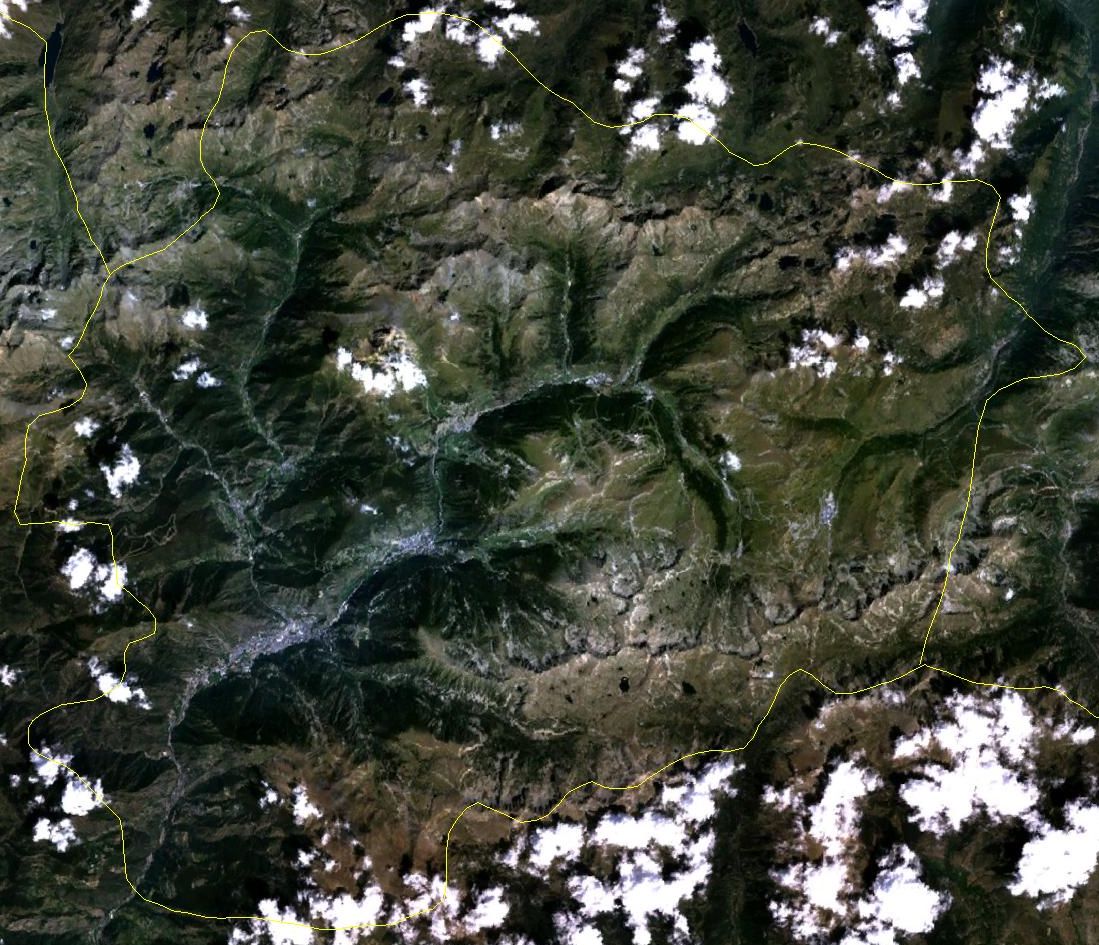
English: Satellite image of Andorra in August. Borders approximate. Taken from Landsat7. |
||
| Date | 6 October 2005 (upload date) | ||
| Source | Public domain satellite imagery taken by screenshot from NASA World Wind software. URL: worldwind://goto/world=Earth&lat=42.55616&lon=1.62127&alt=37335 | ||
| Author | NASA | ||
| Other versions |
|

Licensing edit
| This image is in the public domain because it is a screenshot from NASA’s globe software World Wind using a public domain layer, such as Blue Marble, MODIS, Landsat, SRTM, USGS or GLOBE.
|
 |
File history
Click on a date/time to view the file as it appeared at that time.
| Date/Time | Thumbnail | Dimensions | User | Comment | |
|---|---|---|---|---|---|
| current | 11:53, 6 October 2005 | | 1,099 × 945 (228 KB) | Hautala (talk | contribs) | {{PD-USGov-NASA}} Satellite image of Andorra. Borders approximate. Taken from Landat7. Image captured from NASA World Wind. Location: worldwind://goto/world=Earth&lat=42.55616&lon=1.62127&alt=37335 |
You cannot overwrite this file.
File usage on Commons
The following 3 pages use this file:
File usage on other wikis
The following other wikis use this file:
- Usage on azb.wikipedia.org
- Usage on el.wikipedia.org
- Usage on en.wikipedia.org
- Usage on it.wikipedia.org
- Usage on it.wikibooks.org
- Usage on oc.wiktionary.org
- Usage on pl.wikipedia.org
- Usage on vec.wikipedia.org