File:Scharhörn Tiefwasserhafenkarte.jpg

Size of this preview: 800 × 561 pixels. Other resolutions: 320 × 224 pixels | 640 × 449 pixels | 1,024 × 718 pixels | 1,280 × 897 pixels | 2,560 × 1,794 pixels | 4,227 × 2,963 pixels.
Original file (4,227 × 2,963 pixels, file size: 2.17 MB, MIME type: image/jpeg)
Captions
Captions
Add a one-line explanation of what this file represents
Summary edit
| Description |
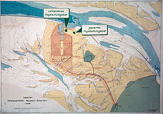
Deutsch: Karte des geplanten Hamburger Tiefwasserhafens und der künstlichen Insel |
| Date | |
| Source | Public Display at Scharhörn |
| Author | Amt für Strom und Hafenbau, Hamburg |
| Other versions |
|

Licensing edit
| This image is in the public domain according to German copyright law because it is part of a statute, ordinance, official decree or judgment (official work) issued by a German authority or court (§ 5 Abs.1 UrhG).
|
 |
File history
Click on a date/time to view the file as it appeared at that time.
| Date/Time | Thumbnail | Dimensions | User | Comment | |
|---|---|---|---|---|---|
| current | 14:31, 9 February 2014 | | 4,227 × 2,963 (2.17 MB) | Aeroid (talk | contribs) | User created page with UploadWizard |
You cannot overwrite this file.
File usage on Commons
The following page uses this file:
File usage on other wikis
The following other wikis use this file:
- Usage on ca.wikipedia.org
- Usage on de.wikipedia.org