File:Scollay Square plan.png

Size of this preview: 800 × 475 pixels. Other resolutions: 320 × 190 pixels | 640 × 380 pixels | 1,024 × 607 pixels | 1,280 × 759 pixels | 2,448 × 1,452 pixels.
Original file (2,448 × 1,452 pixels, file size: 247 KB, MIME type: image/png)
Captions
Captions
Add a one-line explanation of what this file represents
| Description |
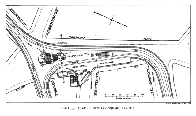
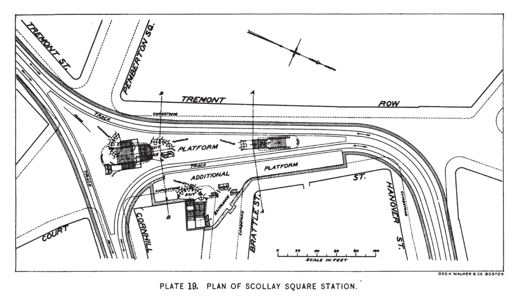
English: Original plan for the Scollay Square station (now Government Center) on the Tremont Street Subway. The station has been substantially modified from these plans, including a rerouting of the Brattle Loop and the northbound platform and the construction of the Blue Line underneath. Note the second, now-unused platform serving Brattle Loop. |
||
| Date | |||
| Source | Annual report of the Boston Transit Commission, Volume 4 (1898) from Google Books; page 47 | ||
| Author | Boston Transit Commission. Author of individual station plans is unknown. | ||
| Permission (Reusing this file) |
|
File history
Click on a date/time to view the file as it appeared at that time.
| Date/Time | Thumbnail | Dimensions | User | Comment | |
|---|---|---|---|---|---|
| current | 02:51, 8 November 2011 | | 2,448 × 1,452 (247 KB) | Pi.1415926535 (talk | contribs) | {{Information |Description ={{en|1=Original plan for the Scollay Square station (now Government Center) on the Tremont Street Subway. The station has been substantially modified from these plans, including a rerouting of the Brattle Loop and the northb |
You cannot overwrite this file.
File usage on Commons
The following page uses this file: