File:Scranton-Wilkes-Barre Metropolitan Area.png
No higher resolution available.
Scranton-Wilkes-Barre_Metropolitan_Area.png (565 × 361 pixels, file size: 28 KB, MIME type: image/png)
Captions
Captions
Add a one-line explanation of what this file represents
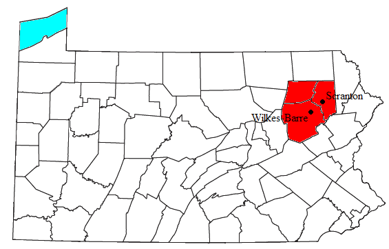
| Description | Locator map of the Scranton-Wilkes-Barre Metropolitan Statistical Area in the northeastern part of the U.S. state of Pennsylvania. | ||
| Date | |||
| Source | Modified from this United States Census Bureau file, based on this Census definitions list. | ||
| Author | User:Nyttend | ||
| Permission (Reusing this file) |
US Government work is public domain, and my work is
|
File history
Click on a date/time to view the file as it appeared at that time.
| Date/Time | Thumbnail | Dimensions | User | Comment | |
|---|---|---|---|---|---|
| current | 05:01, 10 February 2010 | | 565 × 361 (28 KB) | Yassie (talk | contribs) | added locations of cities of Scranton and Wilkes-Barre |
| 19:32, 30 July 2008 |  | 565 × 361 (27 KB) | Nyttend (talk | contribs) | {{Information |Description=Locator map of the {{w|Wyoming Valley|Scranton-Wilkes-Barre Metropolitan Statistical Area}} in the northeastern part of the {{w|U.S. state}} of {{w|Pennsylvania}}. |Source=Modified from [http://www2.census.gov/geo/maps/general_r |
You cannot overwrite this file.
File usage on Commons
The following page uses this file:
File usage on other wikis
The following other wikis use this file:
- Usage on arz.wikipedia.org
- Usage on en.wikipedia.org
- Usage on es.wikipedia.org
- Usage on ja.wikipedia.org
- Usage on sv.wikipedia.org
- Usage on ur.wikipedia.org
- Usage on www.wikidata.org