File:Seaforth Docks.jpg
No higher resolution available.
Seaforth_Docks.jpg (468 × 299 pixels, file size: 175 KB, MIME type: image/jpeg)
Captions
Captions
Add a one-line explanation of what this file represents
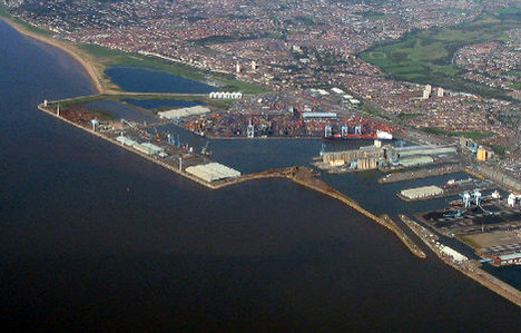
| Description | Aerial photo of the Seaforth Docks, in Crosby, Merseyside, England. |
| Date | Taken 25 September, 2006. |
| Source |
This file was derived from: Aerial photo of Seaforth Docks - geograph.org.uk - 611876.jpg |
| Author | Peter Craine |
| Permission (Reusing this file) |
This file is licensed under the Creative Commons Attribution-Share Alike 2.0 Generic license. Attribution: Peter Craine
|
| Object location | | View this and other nearby images on: OpenStreetMap |
|---|
_heading:45.00&language=en)
File history
Click on a date/time to view the file as it appeared at that time.
| Date/Time | Thumbnail | Dimensions | User | Comment | |
|---|---|---|---|---|---|
| current | 12:43, 27 August 2008 | | 468 × 299 (175 KB) | Jza84 (talk | contribs) | {{Information |Description=Aerial photo of the Seaforth Docks, in Crosby, Merseyside, England. |Source=[http://www.geograph.org.uk/photo/611876 geograph.org.uk] |Date=Taken 25 September, 2006. |Author=Peter Craine |Permission={{geograph|611876|Peter Crain |
You cannot overwrite this file.
File usage on Commons
The following page uses this file:
File usage on other wikis
The following other wikis use this file:
- Usage on af.wikipedia.org
- Usage on ca.wikipedia.org
- Usage on en.wikipedia.org
- Usage on fa.wikipedia.org
- Usage on hak.wikipedia.org
- Usage on it.wikipedia.org
- Usage on lt.wikipedia.org
- Usage on no.wikipedia.org
- Usage on pl.wikipedia.org
- Usage on tr.wikipedia.org
- Usage on zh.wikipedia.org