File:Sediment in the Caspian Sea (MODIS 2021-10-12).jpg

Original file (2,287 × 1,948 pixels, file size: 285 KB, MIME type: image/jpeg)
Captions
Captions
Summary edit
.jpg&action=edit§ion=1)
| Description |
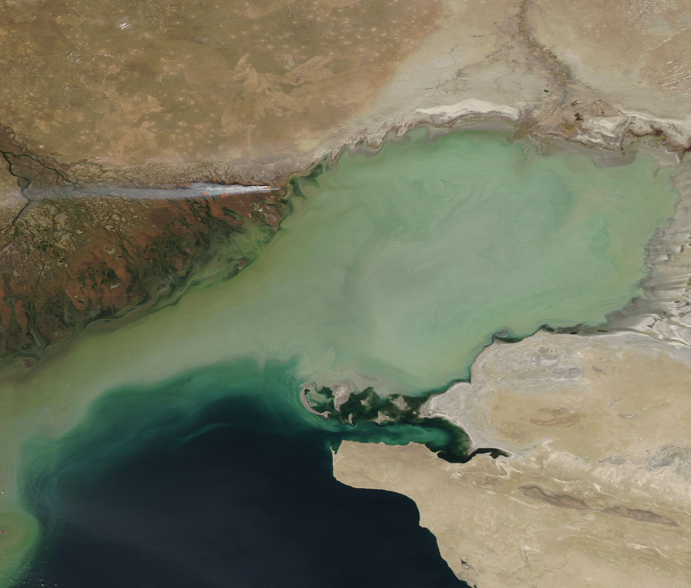
English: The waters of the north-eastern Caspian Sea were stained a milky green as fires burned along the edge of the Volga Delta in early October 2021. The Moderate Resolution Imaging Spectroradiometer (MODIS) on board NASA’s Aqua satellite acquired this true-color image of the scene on October 8.
The Caspian Sea is the world’s largest landlocked body of water. Stretching 1,200 kilometers (750 miles) from north to south, it intersects five countries in Asia and Europe, with Kazakhstan wrapped around the shallow waters of the northeastern corner of the lake. It is here that the massive Volga River and the smaller Ural River pour freshwater into the Caspian Sea, along with heavy sediment. The inflow of both of these rivers also creates currents that can lift sediment from the muddy bottom and carry it in swirls along with the currents. Sediment appears tan when it floats near the top of the water, but as it sinks and disperses into deeper and clearer water, the color changes to a range of light blues, turquoises, and greens. Several red “hot spots” sit along the edge of the greening that marks the Volga Delta. These mark areas where the thermal bands on the MODIS instrument detected high temperatures. When combined with typical smoke—as in this image—such hot spots mark actively burning fire. The large, light gray smoke plume stretches nearly due west, driven by strong winds. While it’s not possible to determine the cause of a fire from a satellite image, give the time of year, the location of the fires, and that there are several of them, these fires are most likely to be either agricultural in nature or prescribed burns used to manage land. |
||
| Date | Taken on 8 October 2021 | ||
| Source |
Sediment in the Caspian Sea (direct link)
|
||
| Author | MODIS Land Rapid Response Team, NASA GSFC |
| This media is a product of the Aqua mission Credit and attribution belongs to the mission team, if not already specified in the "author" row |
Licensing edit
.jpg&action=edit§ion=2)
| This file is in the public domain in the United States because it was solely created by NASA. NASA copyright policy states that "NASA material is not protected by copyright unless noted". (See Template:PD-USGov, NASA copyright policy page or JPL Image Use Policy.) | ||
 |
Warnings:
|
File history
Click on a date/time to view the file as it appeared at that time.
| Date/Time | Thumbnail | Dimensions | User | Comment | |
|---|---|---|---|---|---|
| current | 18:50, 28 January 2024 | | 2,287 × 1,948 (285 KB) | OptimusPrimeBot (talk | contribs) | #Spacemedia - Upload of http://modis.gsfc.nasa.gov/gallery/images/image10122021_250m.jpg via Commons:Spacemedia |
You cannot overwrite this file.
File usage on Commons
There are no pages that use this file.
.jpg&oldid=846567836)