File:Sediment in the Caspian Sea (MODIS 2022-05-24).jpg

Original file (2,309 × 1,737 pixels, file size: 892 KB, MIME type: image/jpeg)
Captions
Captions
Summary edit
.jpg&action=edit§ion=1)
| Description |
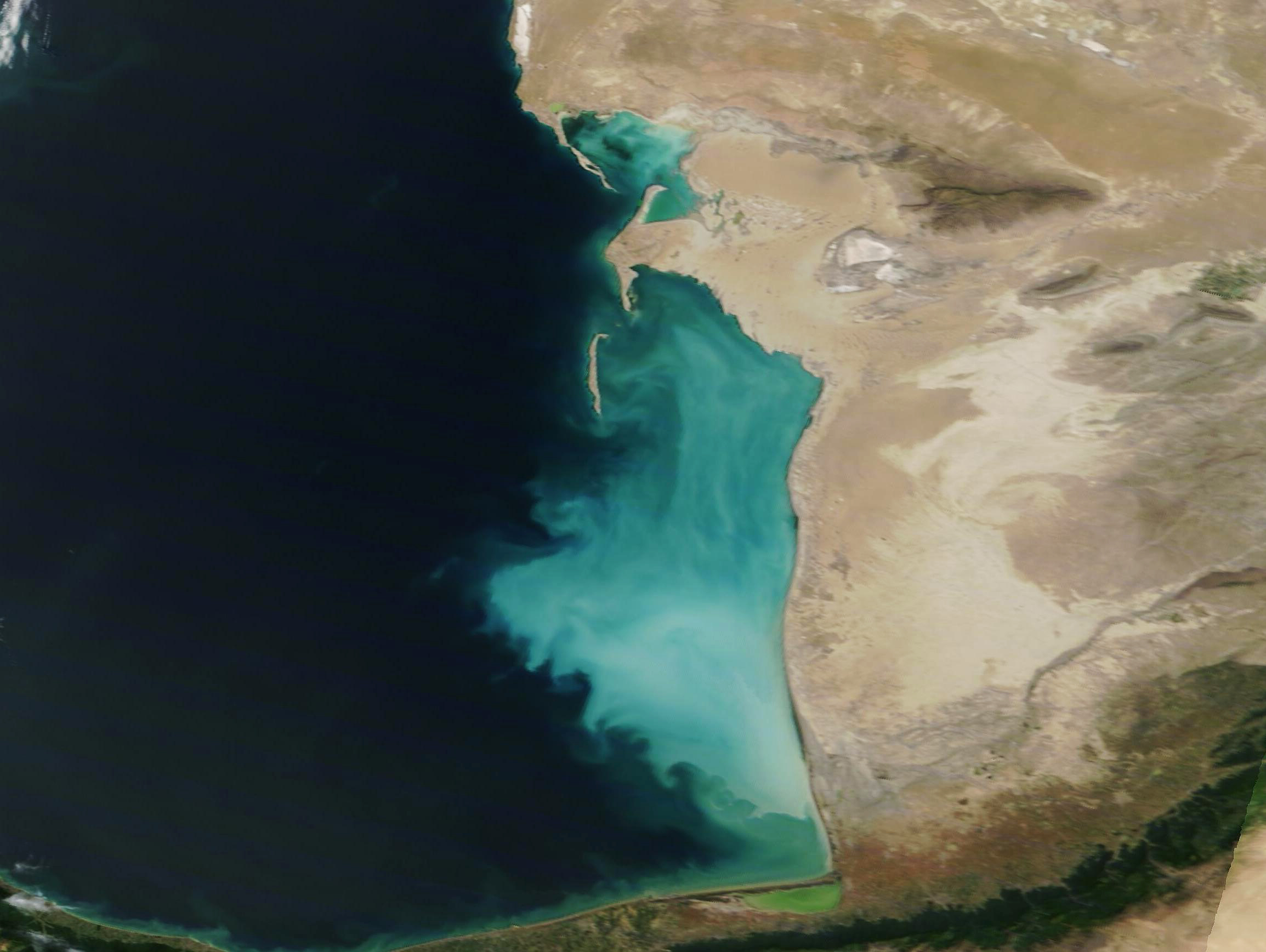
English: The Caspian Sea wins the prize for being the largest closed body on Earth, with a volume estimate at about 78,000 cubic kilometers and spanning a surface area of roughly 146,720 square miles (380,000 square kilometers). That’s a surface area larger than the country of Germany.
The Caspian Sea is sometimes divided into three parts, ecologically speaking. In the north, the sea is shallow, with a mean depth of only about 32 feet (10 meters), while the central sea deepens to 2,585 feet (788 meters). The deepest part of the Caspian Sea reaches 3,363 feet (1,025 meters) in the southern section. Despite the deep water, the southeastern Caspian Sea just off the coast of Turkmenistan hosts a wide area of marine shallows, where the mud-covered bottom lies under a layer of water that stays less than 98 feet (30 meters). This coastal shelf stretches 124 miles (200 km) from north to south and 75 miles (120 km) from the shoreline into the sea. Beyond this shelf, the seafloor takes a deep plunge; however, the waters over the shelf are perpetually turbid as the ever-active wind stirs mud and sediment up from the shallows. On May 23, 2022, the Moderate Resolution Imaging Spectroradiometer (MODIS) on board NASA’s Terra satellite acquired a true-color image of brightly-colored sediment in the Caspian Sea off of the coast of Turkmenistan. A small bit of the coast of Iran is also visible at the bottom of the image. The gorgeous color lies almost entirely over the shelf of marine shallows located in this section of the of the Caspian Sea. |
||
| Date | Taken on 23 May 2022 | ||
| Source |
Sediment in the Caspian Sea (direct link)
|
||
| Author | MODIS Land Rapid Response Team, NASA GSFC |
| This media is a product of the Terra mission Credit and attribution belongs to the mission team, if not already specified in the "author" row |
Licensing edit
.jpg&action=edit§ion=2)
| This file is in the public domain in the United States because it was solely created by NASA. NASA copyright policy states that "NASA material is not protected by copyright unless noted". (See Template:PD-USGov, NASA copyright policy page or JPL Image Use Policy.) | ||
 |
Warnings:
|
File history
Click on a date/time to view the file as it appeared at that time.
| Date/Time | Thumbnail | Dimensions | User | Comment | |
|---|---|---|---|---|---|
| current | 22:03, 9 January 2024 | | 2,309 × 1,737 (892 KB) | OptimusPrimeBot (talk | contribs) | #Spacemedia - Upload of http://modis.gsfc.nasa.gov/gallery/images/image05242022_250m.jpg via Commons:Spacemedia |
You cannot overwrite this file.
File usage on Commons
There are no pages that use this file.
.jpg&oldid=840278639)