File:Sediment in the Strait of Tartary (MODIS 2020-09-16).jpg

Size of this preview: 800 × 580 pixels. Other resolutions: 320 × 232 pixels | 640 × 464 pixels | 1,024 × 742 pixels | 1,280 × 928 pixels | 2,560 × 1,856 pixels | 3,162 × 2,292 pixels.
Original file (3,162 × 2,292 pixels, file size: 478 KB, MIME type: image/jpeg)
Captions
Captions
The Moderate Resolution Imaging Spectroradiometer (MODIS) on board NASA’s Terra satellite acquired a true-color image of the scene on September 12.
Summary edit
.jpg&action=edit§ion=1)
| Description |
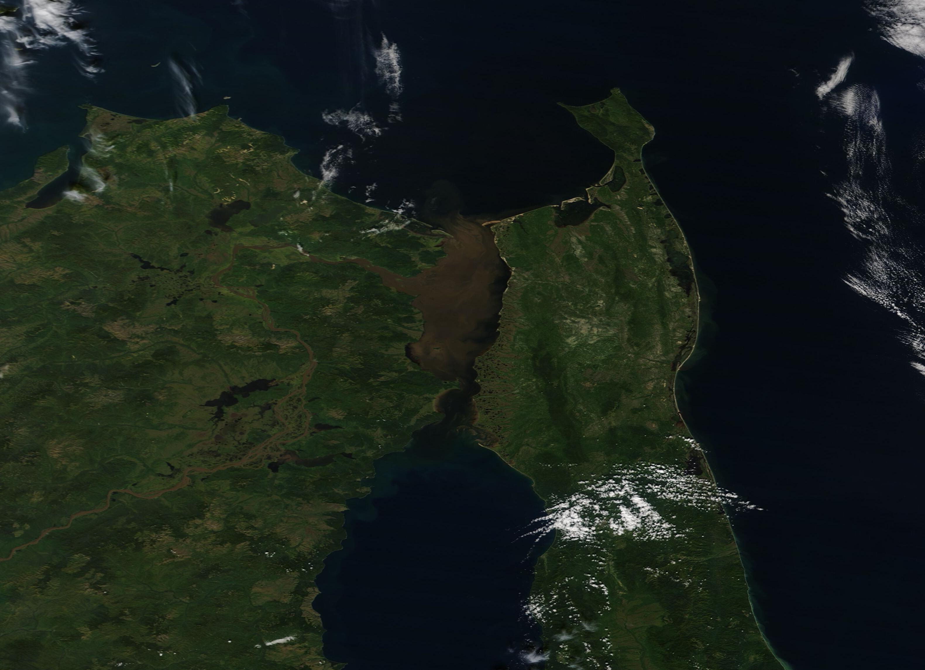
English: Swirls of brown sediment stained the blue waters of the Strait of Tartary in mid-September 2020. The Moderate Resolution Imaging Spectroradiometer (MODIS) on board NASA’s Terra satellite acquired a true-color image of the scene on September 12.
The Strait of Tartary (Tartar Strait) sits between the eastern Russian mainland and Sakhalin Island, connecting the Sea of Okhotsk (north) from the Sea of Japan (south). At the narrowest point, the Strait is a mere 4.5 mi (7 km) wide but it still provides an important shipping lane and in the wider stretches, harbors several important Russian seaports. It is typically clogged with ice between mid-November and mid-May. The Strait receives fresh water from the Amur River, the world’s tenth-longest river. The Amur rises in Mongolia, then flows east along the Chinese-Russian border before turning northeast and ultimately emptying into the Strait of Tartary. As it passes mountains, steppe, agricultural land, and towns, the Amur collects sediment. When the flow of the river is strong, the sediment can be carried thousands of miles only to be spilled into the Strait of Tartary. According to a study published in Marine Physics in 2017, the spreading of the sediment plume into the Strait of Tartary typically takes place only during the Amur’s freshet periods (times of high water flows, typically during ice melt), and when there is strong western wind forcing, which induces southward transport. The study states, “The average duration of this process during the ice-free season is estimated as 15 days; however, in individual years, it can be as short as several days”. |
||
| Date | Taken on 12 September 2020 | ||
| Source |
Sediment in the Strait of Tartary (direct link)
|
||
| Author | MODIS Land Rapid Response Team, NASA GSFC |
| This media is a product of the Terra mission Credit and attribution belongs to the mission team, if not already specified in the "author" row |
Licensing edit
.jpg&action=edit§ion=2)
| This file is in the public domain in the United States because it was solely created by NASA. NASA copyright policy states that "NASA material is not protected by copyright unless noted". (See Template:PD-USGov, NASA copyright policy page or JPL Image Use Policy.) | ||
 |
Warnings:
|
File history
Click on a date/time to view the file as it appeared at that time.
| Date/Time | Thumbnail | Dimensions | User | Comment | |
|---|---|---|---|---|---|
| current | 02:40, 17 February 2024 | | 3,162 × 2,292 (478 KB) | OptimusPrimeBot (talk | contribs) | #Spacemedia - Upload of http://modis.gsfc.nasa.gov/gallery/images/image09162020_250m.jpg via Commons:Spacemedia |
You cannot overwrite this file.
File usage on Commons
There are no pages that use this file.
File usage on other wikis
The following other wikis use this file:
- Usage on ru.wikipedia.org
.jpg&oldid=852802620)