File:Seguia el Hamra political blank.png

Size of this preview: 800 × 389 pixels. Other resolutions: 320 × 156 pixels | 640 × 311 pixels | 1,024 × 498 pixels | 1,728 × 840 pixels.
Original file (1,728 × 840 pixels, file size: 88 KB, MIME type: image/png)
Captions
Captions
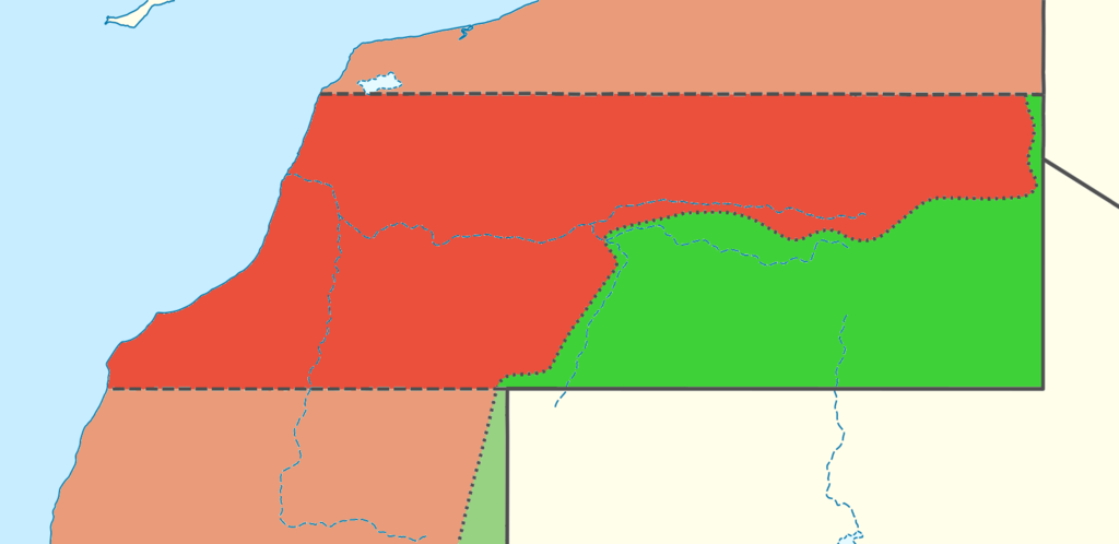
Areas controlled by Morocco and Polisario in Seguia el-Hamra.
Summary edit
| Description |
Français : Carte réalisée à partir de File:Western Sahara location map.svg. |
| Date | |
| Source | Own work |
| Author | GrandEscogriffe |
| Other versions |
|

Licensing edit
I, the copyright holder of this work, hereby publish it under the following license:
This file is licensed under the Creative Commons Attribution-Share Alike 4.0 International license.
- You are free:
- to share – to copy, distribute and transmit the work
- to remix – to adapt the work
- Under the following conditions:
- attribution – You must give appropriate credit, provide a link to the license, and indicate if changes were made. You may do so in any reasonable manner, but not in any way that suggests the licensor endorses you or your use.
- share alike – If you remix, transform, or build upon the material, you must distribute your contributions under the same or compatible license as the original.
File history
Click on a date/time to view the file as it appeared at that time.
| Date/Time | Thumbnail | Dimensions | User | Comment | |
|---|---|---|---|---|---|
| current | 21:16, 10 September 2021 | | 1,728 × 840 (88 KB) | GrandEscogriffe (talk | contribs) | retrait de limite de région marocaine. détails |
| 15:30, 10 September 2021 |  | 1,728 × 840 (80 KB) | GrandEscogriffe (talk | contribs) | Uploaded own work with UploadWizard |
You cannot overwrite this file.
File usage on Commons
There are no pages that use this file.
File usage on other wikis
The following other wikis use this file:
- Usage on fr.wikipedia.org