File:Serbia NATO Locator Lambert.svg

Size of this PNG preview of this SVG file: 600 × 372 pixels. Other resolutions: 320 × 198 pixels | 640 × 397 pixels | 1,024 × 635 pixels | 1,280 × 794 pixels | 2,560 × 1,587 pixels.
Original file (SVG file, nominally 600 × 372 pixels, file size: 145 KB)
Captions
Captions
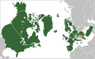
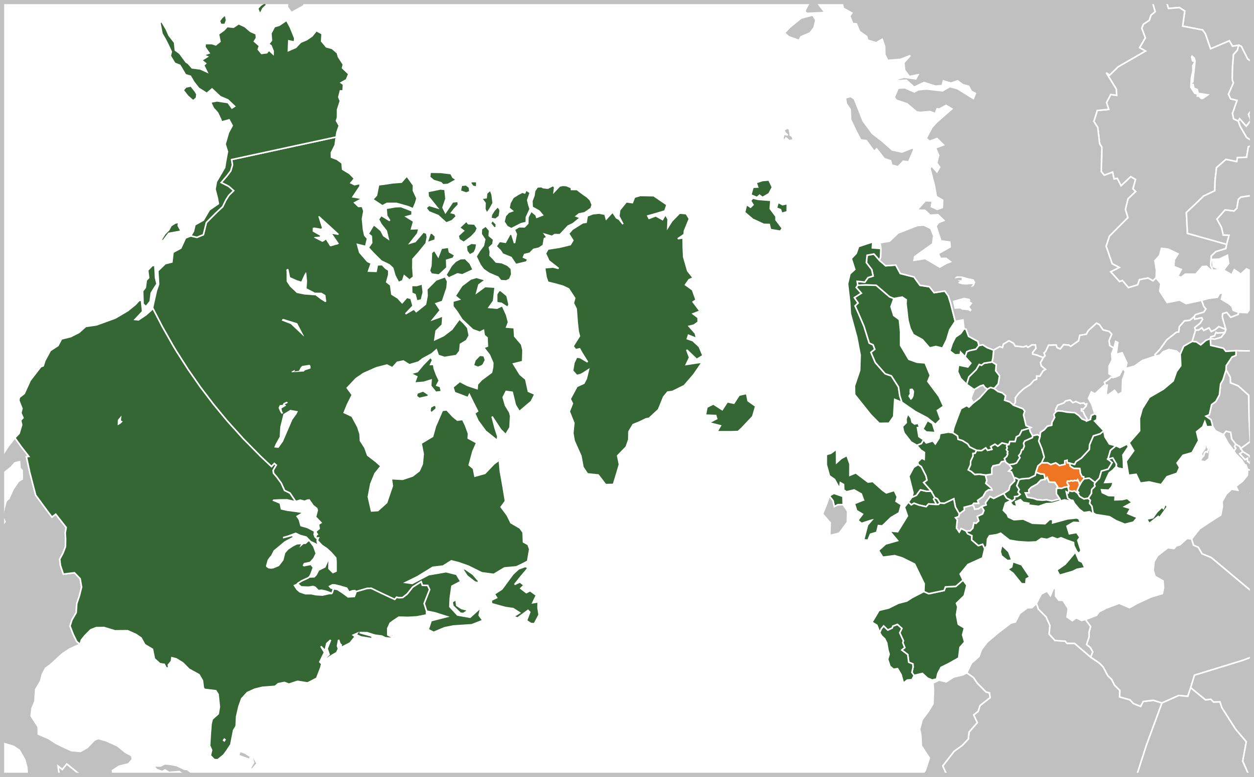
Map showing the locations of Serbia and NATO
Summary edit
| Description | |
| Date | |
| Source | Own work |
| Author | Justin Kunimune |
Licensing edit
I, the copyright holder of this work, hereby publish it under the following license:
This file is licensed under the Creative Commons Attribution-Share Alike 4.0 International license.
- You are free:
- to share – to copy, distribute and transmit the work
- to remix – to adapt the work
- Under the following conditions:
- attribution – You must give appropriate credit, provide a link to the license, and indicate if changes were made. You may do so in any reasonable manner, but not in any way that suggests the licensor endorses you or your use.
- share alike – If you remix, transform, or build upon the material, you must distribute your contributions under the same or compatible license as the original.
File history
Click on a date/time to view the file as it appeared at that time.
| Date/Time | Thumbnail | Dimensions | User | Comment | |
|---|---|---|---|---|---|
| current | 15:23, 8 March 2024 | | 600 × 372 (145 KB) | Justinkunimune (talk | contribs) | sweden is now part of NATO |
| 21:25, 9 September 2023 |  | 600 × 372 (144 KB) | Justinkunimune (talk | contribs) | Uploaded own work with UploadWizard |
You cannot overwrite this file.
File usage on Commons
There are no pages that use this file.
File usage on other wikis
The following other wikis use this file:
- Usage on en.wikipedia.org