File:Shenzhen Metro Che Kung Temple Hub Feb2021.jpg
Size of this preview: 337 × 600 pixels. Other resolutions: 135 × 240 pixels | 481 × 856 pixels.
Original file (481 × 856 pixels, file size: 77 KB, MIME type: image/jpeg)
Captions
Captions
Add a one-line explanation of what this file represents
Summary edit
| Description |
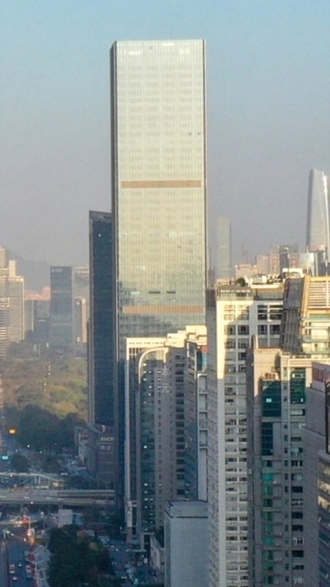
中文:车公庙地铁站汇通大厦,位于深圳福田区车公庙,楼高269米。
English: Shenzhen Metro Che Kung Temple Hub, located at Chegongmiao, Futian District, Shenzhen. It's stand 269 metres tall. |
| Date | |
| Source | Own work |
| Author | Charlie fong |
| Camera location | | View this and other nearby images on: OpenStreetMap |
|---|
Licensing edit
This file is licensed under the Creative Commons Attribution-Share Alike 4.0 International license.
- You are free:
- to share – to copy, distribute and transmit the work
- to remix – to adapt the work
- Under the following conditions:
- attribution – You must give appropriate credit, provide a link to the license, and indicate if changes were made. You may do so in any reasonable manner, but not in any way that suggests the licensor endorses you or your use.
- share alike – If you remix, transform, or build upon the material, you must distribute your contributions under the same or compatible license as the original.
File history
Click on a date/time to view the file as it appeared at that time.
| Date/Time | Thumbnail | Dimensions | User | Comment | |
|---|---|---|---|---|---|
| current | 11:51, 17 February 2022 | | 481 × 856 (77 KB) | Tcweee (talk | contribs) | Uploaded a work by Charlie fong from {{own}} with UploadWizard |
You cannot overwrite this file.
File usage on Commons
There are no pages that use this file.
File usage on other wikis
The following other wikis use this file:
- Usage on en.wikipedia.org
- Usage on ru.wikipedia.org