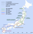
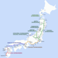
File:Shinkansen map 201009.png

Size of this preview: 581 × 600 pixels. Other resolutions: 232 × 240 pixels | 465 × 480 pixels | 744 × 768 pixels | 992 × 1,024 pixels | 1,984 × 2,048 pixels | 3,100 × 3,200 pixels.
Original file (3,100 × 3,200 pixels, file size: 373 KB, MIME type: image/png)
File information
Structured data
Captions
Captions
Add a one-line explanation of what this file represents
Summary edit
| DescriptionShinkansen map 201009.png |
English: Map of Shinkansen network. (2004-03-13 – 2010-12-03) |
||||||||||||||||||||||||||||||||
| Date | |||||||||||||||||||||||||||||||||
| Source | Own work | ||||||||||||||||||||||||||||||||
| Author | Hisagi (氷鷺) | ||||||||||||||||||||||||||||||||
| Other versions |
|
Licensing edit
I, the copyright holder of this work, hereby publish it under the following licenses:
This file is licensed under the Creative Commons Attribution-Share Alike 3.0 Unported license.
- You are free:
- to share – to copy, distribute and transmit the work
- to remix – to adapt the work
- Under the following conditions:
- attribution – You must give appropriate credit, provide a link to the license, and indicate if changes were made. You may do so in any reasonable manner, but not in any way that suggests the licensor endorses you or your use.
- share alike – If you remix, transform, or build upon the material, you must distribute your contributions under the same or compatible license as the original.

|
Permission is granted to copy, distribute and/or modify this document under the terms of the GNU Free Documentation License, Version 1.2 or any later version published by the Free Software Foundation; with no Invariant Sections, no Front-Cover Texts, and no Back-Cover Texts. A copy of the license is included in the section entitled GNU Free Documentation License.http://www.gnu.org/copyleft/fdl.htmlGFDLGNU Free Documentation Licensetruetrue |
You may select the license of your choice.
File history
Click on a date/time to view the file as it appeared at that time.
| Date/Time | Thumbnail | Dimensions | User | Comment | |
|---|---|---|---|---|---|
| current | 23:18, 7 March 2011 |  | 3,100 × 3,200 (373 KB) | Hisagi (talk | contribs) | Ōyama→Oyama |
| 04:44, 5 March 2011 |  | 3,100 × 3,200 (394 KB) | Hisagi (talk | contribs) | 福井と南越の逆転を訂正 | |
| 22:12, 15 September 2010 |  | 3,060 × 3,200 (300 KB) | Hisagi (talk | contribs) | 使用車両を除去。文字サイズの調整。北海道新幹線の色の調整。確定している開業日を追加。 | |
| 12:45, 15 September 2010 |  | 3,060 × 3,200 (308 KB) | Hisagi (talk | contribs) | 駅名をハイフンで繋ぐ表記に変更。新八代-博多間の線形を修正。使用車両を除去。中央・北海道の路線名の文字を小さく、東京駅の文字を大きく。 | |
| 14:30, 14 September 2010 |  | 3,060 × 3,200 (317 KB) | DAJF (talk | contribs) | Removed rolling stock names, as these will become out-of-date very rapidly | |
| 08:25, 7 September 2010 |  | 3,060 × 3,200 (309 KB) | Hisagi (talk | contribs) | 凡例などを追加 | |
| 08:14, 6 September 2010 |  | 3,060 × 3,200 (246 KB) | Hisagi (talk | contribs) | 中央新幹線(長野県内は2案)と、北陸新幹線の敦賀以西3案を追加。長音のO,Uをマクロン付きにし、仮称の駅名には注意書きを追加。 | |
| 23:01, 4 September 2010 |  | 3,000 × 3,000 (219 KB) | Hisagi (talk | contribs) | {{Information |Description={{en|1=Map of Shinkansen network. Bold solid lines are Shinkansen lines in service, thin lines are Mini Shinkansen lines. Bold broken lines are in building. Thin broken lines are in planning.}} |Source={{own}} |Author=[[User:His |
You cannot overwrite this file.
File usage on Commons
There are no pages that use this file.