File:Siberian Khanate map English.svg

Size of this PNG preview of this SVG file: 488 × 600 pixels. Other resolutions: 195 × 240 pixels | 390 × 480 pixels | 625 × 768 pixels | 833 × 1,024 pixels | 1,666 × 2,048 pixels | 3,050 × 3,750 pixels.
Original file (SVG file, nominally 3,050 × 3,750 pixels, file size: 113 KB)
Captions
Captions
Add a one-line explanation of what this file represents
Summary edit
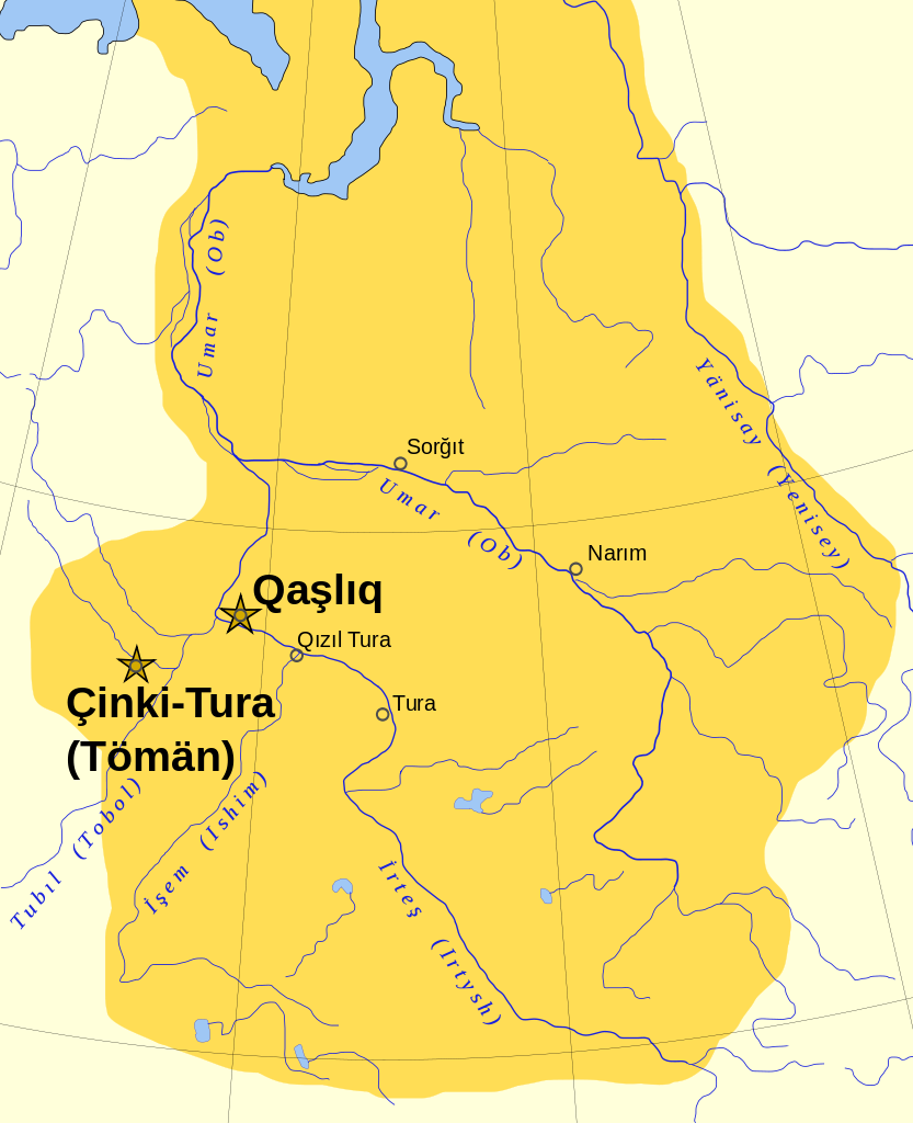
| Description |
Русский: Граница ханство не доходила до Севернего Ледовитого океана и Енисея. |
| Date | Unknown date |
| Source | Own work |
| Author | |
| Other versions |
[]
|


Licensing edit
| I, the copyright holder of this work, release this work into the public domain. This applies worldwide. In some countries this may not be legally possible; if so: I grant anyone the right to use this work for any purpose, without any conditions, unless such conditions are required by law. |
File history
Click on a date/time to view the file as it appeared at that time.
| Date/Time | Thumbnail | Dimensions | User | Comment | |
|---|---|---|---|---|---|
| current | 07:43, 15 February 2011 | | 3,050 × 3,750 (113 KB) | Amga (talk | contribs) | corrected position of en:Narym |
| 14:54, 21 January 2007 |  | 3,050 × 3,750 (137 KB) | Untifler (talk | contribs) | Category:Siberia | |
| 14:49, 21 January 2007 |  | 3,050 × 3,750 (137 KB) | Untifler (talk | contribs) | category:Siberia |
You cannot overwrite this file.
File usage on Commons
The following 8 pages use this file:
- User:Untifler/Siberian Khanate
- File:Siberian Khanate map Belarusian.png
- File:Siberian Khanate map English.svg
- File:Siberian Khanate map English revised.svg
- File:Siberian Khanate map Russian.svg
- File:Siberian Khanate map Spanish.svg
- Template:Other versions/Siberian Khanate map
- Category:Khanate of Sibir
File usage on other wikis
The following other wikis use this file:
- Usage on ar.wikipedia.org
- Usage on ast.wikipedia.org
- Usage on de.wikipedia.org
- Usage on en.wikipedia.org
- Usage on eu.wikipedia.org
- Usage on fa.wikipedia.org
- Usage on fi.wikipedia.org
- Usage on fr.wikipedia.org
- Usage on gl.wikipedia.org
- Usage on he.wikipedia.org
- Usage on hi.wikipedia.org
- Usage on hr.wikipedia.org
- Usage on hu.wikipedia.org
- Usage on hy.wikipedia.org
- Usage on incubator.wikimedia.org
- Usage on ja.wikipedia.org
- Usage on ka.wikipedia.org
- Usage on ko.wikipedia.org
- Usage on lt.wikipedia.org
- Usage on lv.wikipedia.org
- Usage on no.wikipedia.org
- Usage on pa.wikipedia.org
- Usage on pl.wikipedia.org
- Usage on pt.wikipedia.org
- Usage on ro.wikipedia.org
- Usage on sco.wikipedia.org
- Usage on sr.wikipedia.org
- Usage on sv.wikisource.org
- Usage on tt.wikipedia.org
- Usage on ur.wikipedia.org
- Usage on vi.wikipedia.org
- Usage on www.wikidata.org
- Usage on zh-yue.wikipedia.org
- Usage on zh.wikipedia.org