File:Sierra Nevada around Mount Whitney and Owens River – from space (ISS).jpg

Size of this preview: 399 × 599 pixels. Other resolutions: 160 × 240 pixels | 319 × 480 pixels | 511 × 768 pixels | 681 × 1,024 pixels | 1,363 × 2,048 pixels | 3,280 × 4,928 pixels.
Original file (3,280 × 4,928 pixels, file size: 3.38 MB, MIME type: image/jpeg)
Captions
Captions
Add a one-line explanation of what this file represents
Summary
edit| Description |
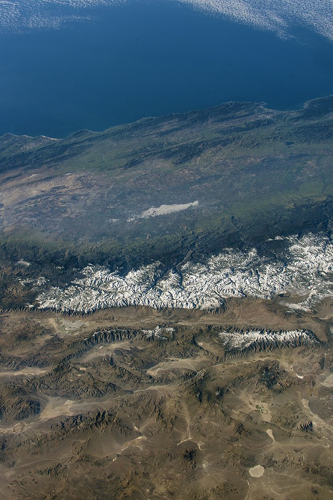
English: Sierra Nevada around Mount Whitney, in parallel and in front of the mountains the Owens River (California and Nevada). Original image captured 2016-12-09 from ISS Expedition 50 Crew. Well visible: Mud lake near Goldfield, Nevada (on the edge of Tonopah Test Range) in the bottom right; Guadalupe-Nipomo Dunes near Santa Maria in the top left; Monterey Bay near Watsonville in the top right |
| Date | Original image captured 2016-12-09 |
| Source | https://earthobservatory.nasa.gov/images/145728/high-points-of-the-sierras |
| Author | NASA Earth Observatory image by Joshua Stevens |
_%E2%80%93_from_space_(ISS).jpg)
.jpg&action=edit§ion=1)
Licensing
edit.jpg&action=edit§ion=2)
| This file is in the public domain in the United States because it was solely created by NASA. NASA copyright policy states that "NASA material is not protected by copyright unless noted". (See Template:PD-USGov, NASA copyright policy page or JPL Image Use Policy.) | ||
 |
Warnings:
|
File history
Click on a date/time to view the file as it appeared at that time.
| Date/Time | Thumbnail | Dimensions | User | Comment | |
|---|---|---|---|---|---|
| current | 14:11, 16 October 2019 | | 3,280 × 4,928 (3.38 MB) | A11w1ss3nd (talk | contribs) | {{Information |description ={{en|1=Sierra Nevada around Mount Whitney, in parallel and in front of the mountains the Owens River (California and Nevada). Original image captured 2016-12-09 from ISS Expedition 50 Crew. Well visible: Big salt pan near Goldfield, Nevada in the bottom right; Guadalupe-Nipomo Dunes near Santa Maria in the top left; Monterey Bay near Watsonville in the top right }} |date =Original image captured 2016-12-09 |source =https://earthobservatory.nasa.... |
You cannot overwrite this file.
File usage on Commons
The following 2 pages use this file:
.jpg&oldid=720302445)