File:Signage at Tataka.jpg
Size of this preview: 800 × 534 pixels. Other resolutions: 320 × 214 pixels | 640 × 427 pixels | 1,024 × 684 pixels | 1,280 × 855 pixels | 2,560 × 1,710 pixels | 4,240 × 2,832 pixels.
Original file (4,240 × 2,832 pixels, file size: 2.95 MB, MIME type: image/jpeg)
Captions
Captions
Add a one-line explanation of what this file represents
Summary
edit
| Description |
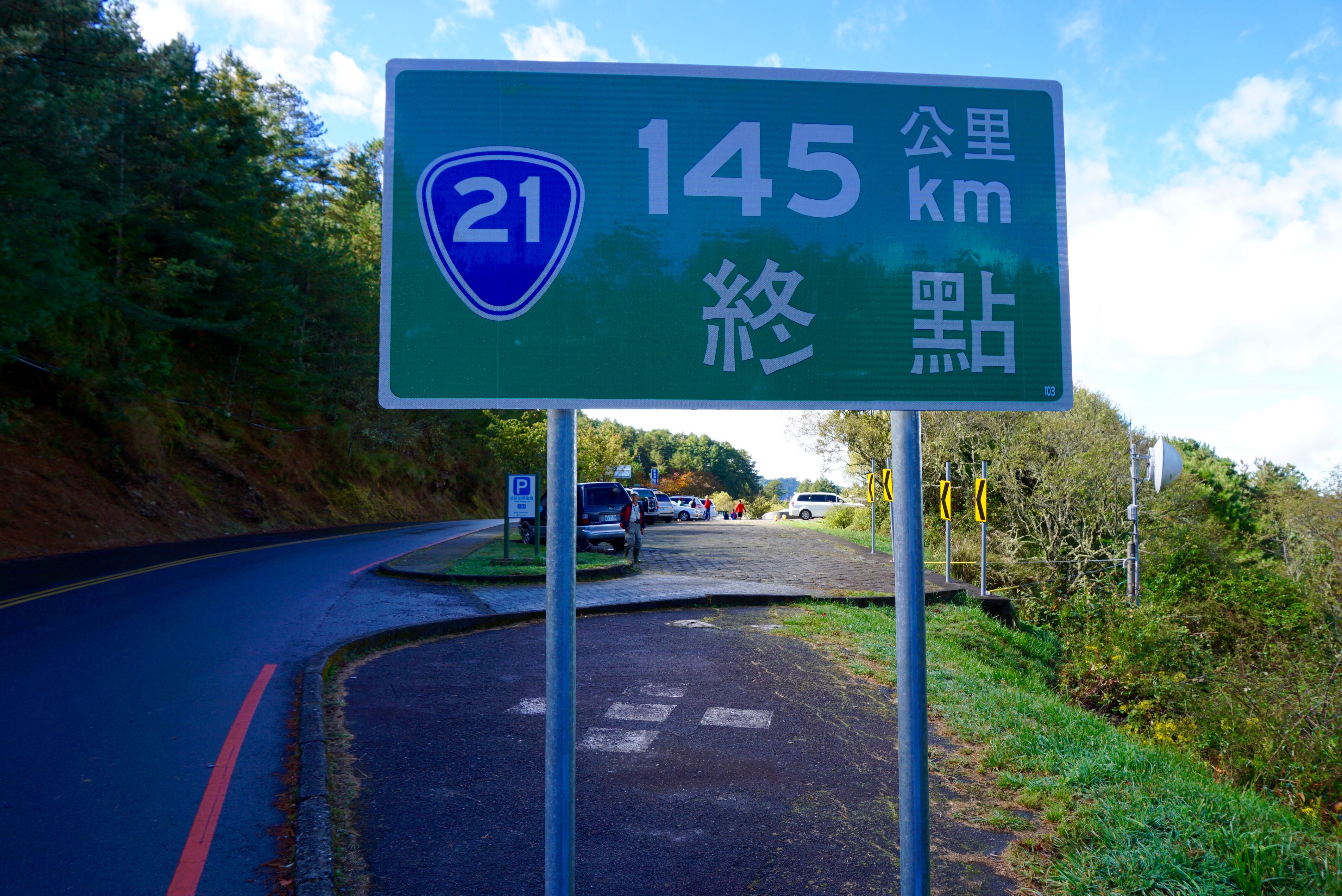
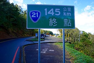
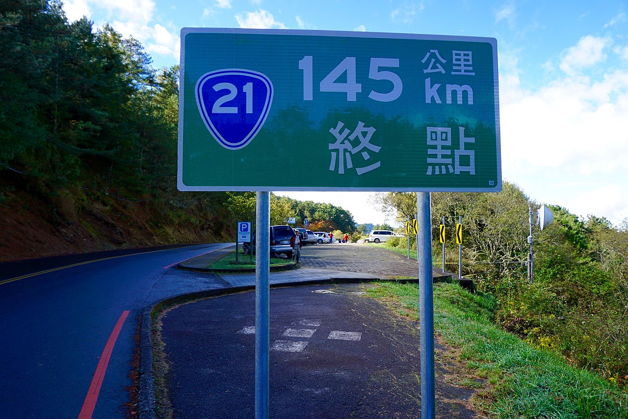
English: The end of Taiwan Highway No.21 at Tataka. Signage here still refers to it as the end for Taiwan Highway No.18. The road was initially called the "New Central Cross-Island Highway", but later became known as the "Sinjhongheng Highway". Variant names, alternatives to official names for a feature.
中文(臺灣):台21線終點設於塔塔加。這裡同時也是台18線終點。這條路最初稱為「新中部橫貫公路」,但後來被改稱為「新中橫公路」。在別名上,已經取代了官方命名所扮演的角色。 |
| Date | |
| Source | https://www.flickr.com/photos/8628250@N08/23578413136/ |
| Author | 禮名畫的生活旅遊日記 FB |
Licensing
edit
| This file is made available under the Creative Commons CC0 1.0 Universal Public Domain Dedication. | |
| The person who associated a work with this deed has dedicated the work to the public domain by waiving all of their rights to the work worldwide under copyright law, including all related and neighboring rights, to the extent allowed by law. You can copy, modify, distribute and perform the work, even for commercial purposes, all without asking permission.
|
| This image was originally posted to Flickr by 禮名畫的生活旅遊日記 FB at https://flickr.com/photos/8628250@N08/23578413136 (archive). It was reviewed on 29 October 2018 by FlickreviewR 2 and was confirmed to be licensed under the terms of the cc-zero. |
File history
Click on a date/time to view the file as it appeared at that time.
| Date/Time | Thumbnail | Dimensions | User | Comment | |
|---|---|---|---|---|---|
| current | 13:17, 13 June 2016 | | 4,240 × 2,832 (2.95 MB) | Liji6085 (talk | contribs) | User created page with UploadWizard |
You cannot overwrite this file.
File usage on Commons
There are no pages that use this file.
File usage on other wikis
The following other wikis use this file: