File:Simandre Gemeindeschema OSM.xcf

Original file (1,403 × 886 pixels, file size: 976 KB, MIME type: image/x-xcf)
Captions
Captions
|
|
| Description |
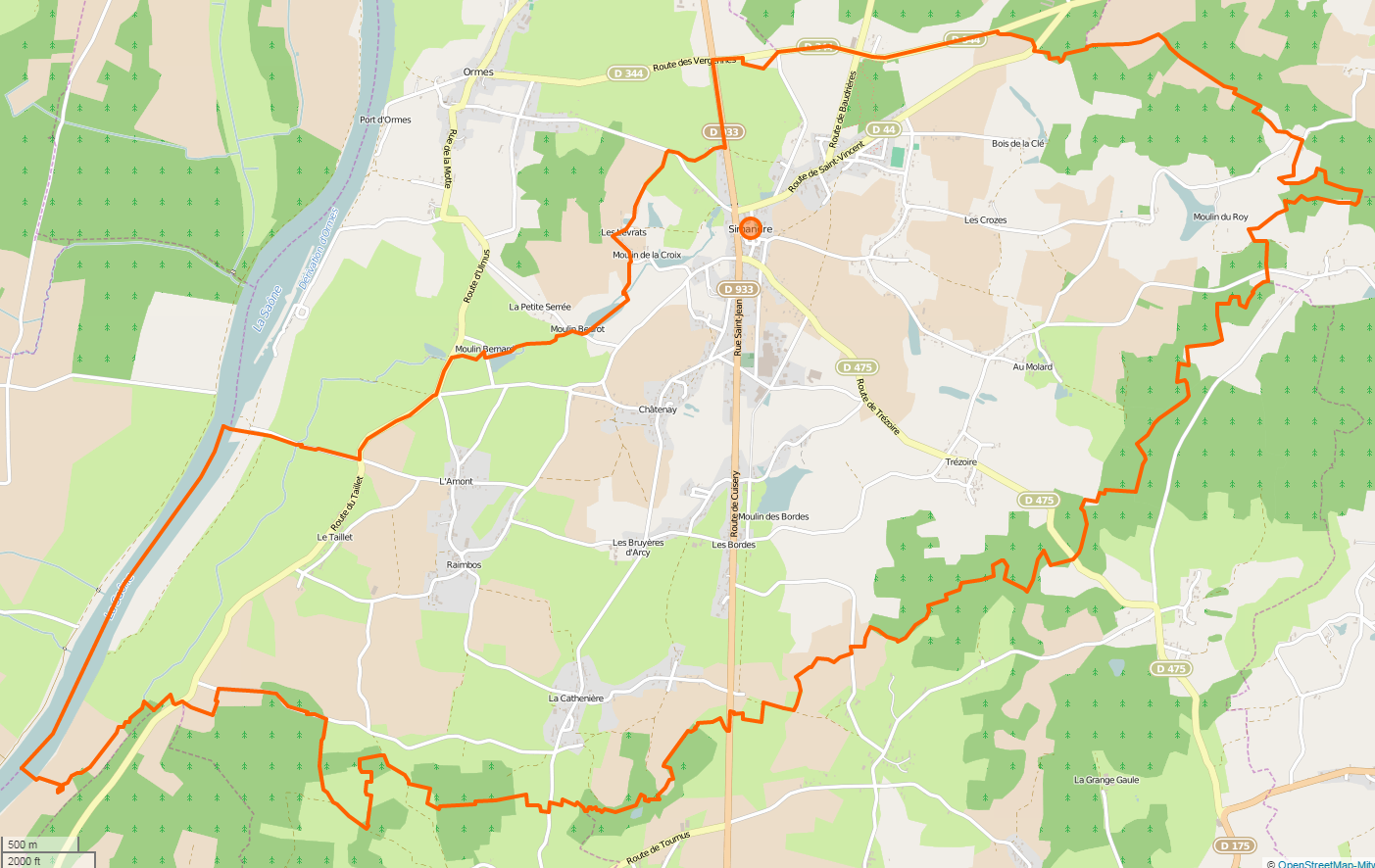
Karte der Gemeinde Simandre - INSEE-Code 71522 This map was created from OpenStreetMap project data, collected by the community. This map may be incomplete, and may contain errors. Don't rely solely on it for navigation.Carte de la commune de Simandre - Code INSEE 71522 |
|||
| Date | (see file history) | |||
| Source | openstreetmap.org | |||
| Creator |
OpenStreetMap contributors |
|||
| Permission (Reusing this file) |
OpenStreetMap data is available under the Open Database License (details). Standard style map tiles are licensed as ODbL Produced Works.
|
|||
| Georeferencing | If inappropriate please set warp_status = skip to hide. |
File history
Click on a date/time to view the file as it appeared at that time.
| Date/Time | Thumbnail | Dimensions | User | Comment | |
|---|---|---|---|---|---|
| current | 11:08, 4 March 2015 |  | 1,403 × 886 (976 KB) | H.p.frei (talk | contribs) | User created page with UploadWizard |
You cannot overwrite this file.
File usage on Commons
The following page uses this file:
File usage on other wikis
The following other wikis use this file:
- Usage on de.wikipedia.org