File:Skull Fork Covered Bridge.jpg
Size of this preview: 800 × 600 pixels. Other resolutions: 320 × 240 pixels | 640 × 480 pixels | 1,024 × 768 pixels | 1,280 × 960 pixels | 2,560 × 1,920 pixels | 2,816 × 2,112 pixels.
Original file (2,816 × 2,112 pixels, file size: 1.69 MB, MIME type: image/jpeg)
Captions
Captions
Add a one-line explanation of what this file represents
| Camera location | | View this and other nearby images on: OpenStreetMap |
|---|
| Description |
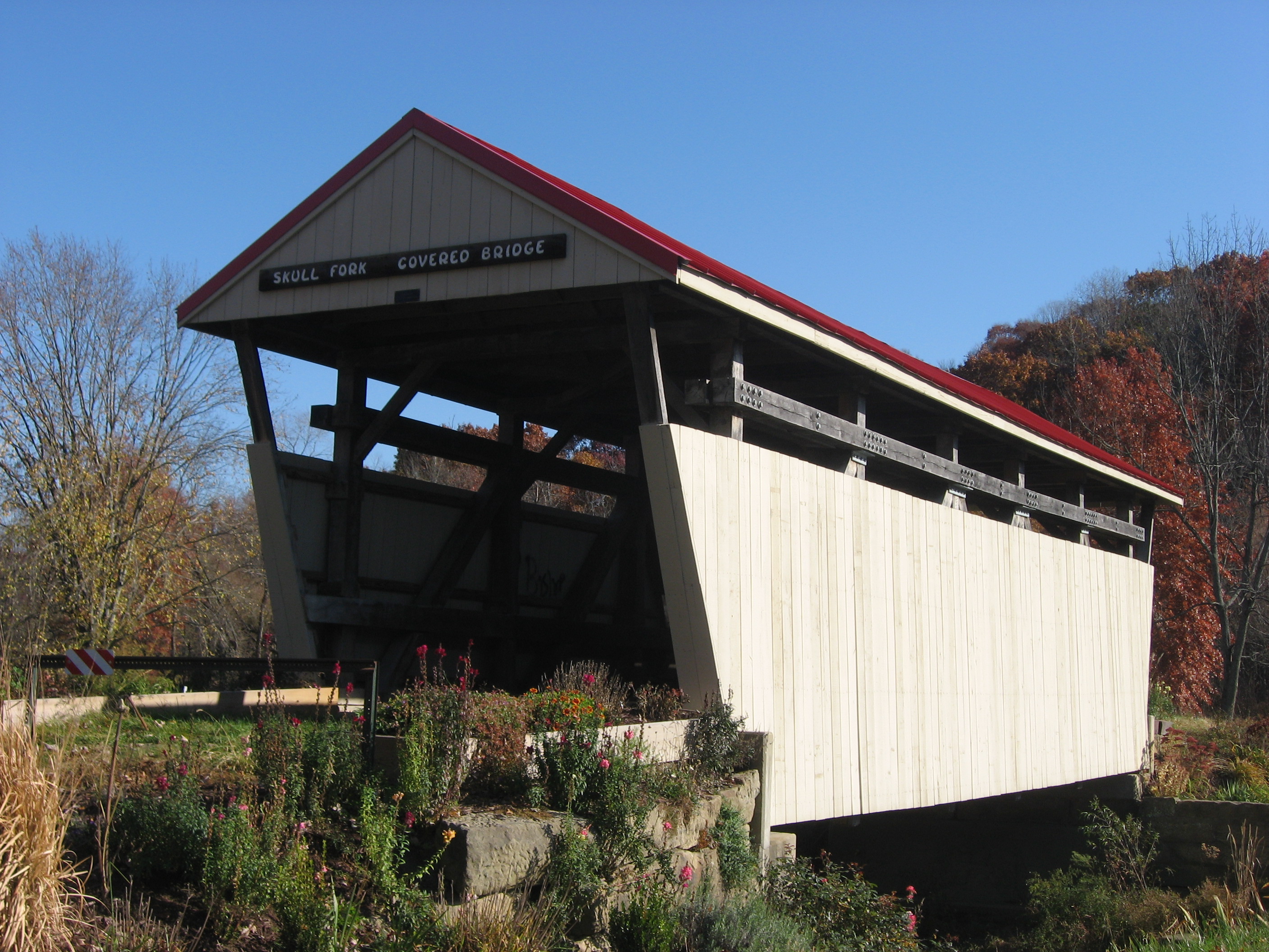
English: Western portal and southern side of the Skull Fork Covered Bridge, a covered bridge that formerly carried Covered Bridge Road over the Skull Fork south of Freeport in Freeport Township, Harrison County, Ohio, United States. It was built circa 1860. |
||
| Date | Taken on 22 October 2012 | ||
| Source | Own work | ||
| Author | Nyttend | ||
| Permission (Reusing this file) |
|
File history
Click on a date/time to view the file as it appeared at that time.
| Date/Time | Thumbnail | Dimensions | User | Comment | |
|---|---|---|---|---|---|
| current | 02:38, 25 October 2012 | | 2,816 × 2,112 (1.69 MB) | Nyttend (talk | contribs) | {{Location|40|14|57.5|N|83|32|0.42|W}} {{Information |Description={{en|Western portal of the Skull Fork Covered Bridge, a {{w|covered bridge}} that formerly carried Covered Bridge Road over the Skull Fork south of {{w|Freeport, Ohio|Freeport}} in carri... |
You cannot overwrite this file.
File usage on Commons
The following 2 pages use this file:
File usage on other wikis
The following other wikis use this file:
- Usage on en.wikipedia.org
- Usage on es.wikipedia.org
- Usage on eu.wikipedia.org
- Usage on fa.wikipedia.org
- Usage on pl.wikipedia.org
- Usage on pt.wikipedia.org
- Usage on ur.wikipedia.org
- Usage on vi.wikipedia.org
- Usage on www.wikidata.org
- Usage on zh.wikipedia.org