File:South-Orkneys-Stub-Picture.png

Size of this preview: 800 × 285 pixels. Other resolutions: 320 × 114 pixels | 640 × 228 pixels | 1,663 × 593 pixels.
Original file (1,663 × 593 pixels, file size: 13 KB, MIME type: image/png)
Captions
Captions
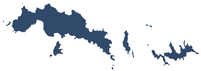
Image of the South Orkney Islands
Summary edit
| Description |
English: Image of the South Orkney Islands in Antarctica |
| Date | |
| Source | Own work |
| Author | Apcbg |
Licensing edit
I, the copyright holder of this work, hereby publish it under the following license:
This file is licensed under the Creative Commons Attribution-Share Alike 4.0 International license.
- You are free:
- to share – to copy, distribute and transmit the work
- to remix – to adapt the work
- Under the following conditions:
- attribution – You must give appropriate credit, provide a link to the license, and indicate if changes were made. You may do so in any reasonable manner, but not in any way that suggests the licensor endorses you or your use.
- share alike – If you remix, transform, or build upon the material, you must distribute your contributions under the same or compatible license as the original.
File history
Click on a date/time to view the file as it appeared at that time.
| Date/Time | Thumbnail | Dimensions | User | Comment | |
|---|---|---|---|---|---|
| current | 17:12, 17 May 2019 | 1,663 × 593 (13 KB) | Apcbg (talk | contribs) | User created page with UploadWizard |
You cannot overwrite this file.
File usage on Commons
The following page uses this file:
File usage on other wikis
The following other wikis use this file:
- Usage on ceb.wikipedia.org
- Usage on en.wikipedia.org
- Robertson Islands
- Powell Island
- Larsen Islands
- Inaccessible Islands
- Scotia Bay
- Saddle Island, South Orkney Islands
- Shagnasty Island
- Sheila Cove
- Shingle Cove
- Mount Susini
- Iceberg Bay
- Washington Strait
- Atriceps Island
- Acuña Island
- Ailsa Craig (South Orkney Islands)
- Aitken Cove
- Laws Glacier
- Murray Islands
- Nigg Rock
- Thule Islands
- Governor Islands (South Orkney Islands)
- Wilton Bay
- Worswick Hill
- Amphibolite Point
- Cape Anderson
- Andreaea Plateau
- Baldred Rock
- Bare Rock
- Cape Barlas
- Beaufoy Ridge
- Cape Bennett
- Breccia Crags
- Bridger Bay
- Brisbane Heights
- Bruce Islands
- Buchan Bay
- Buchanan Point
- Uruguay Cove
- Usnea Ridge
- Cheal Point
- Christoffersen Island
- Cleft Point
- Cockscomb Buttress
- Coffer Island
- Coldblow Col
- Conception Point
- Confusion Island
- Conroy Point
- Oliphant Islands
View more global usage of this file.