File:South Africa Provinces showing NW.png

Size of this preview: 800 × 578 pixels. Other resolutions: 320 × 231 pixels | 640 × 462 pixels | 1,024 × 740 pixels | 1,146 × 828 pixels.
Original file (1,146 × 828 pixels, file size: 20 KB, MIME type: image/png)
Captions
Captions
Add a one-line explanation of what this file represents
Summary
edit
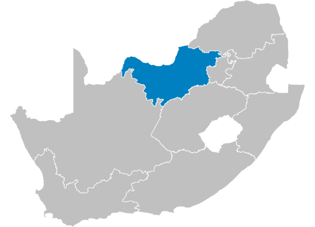
| Description | Map of South Africa showing the Nort-West province after the 12th amendment of the constitution in December 2005. |
| Date | |
| Source | Created by me from Shapefile data from the Municipal Demarcation Board, South Africa. |
| Author | Wayne Dam (User:Waynedam) |
| Permission (Reusing this file) |
Dual-licensed under the GFDL and CC-By-SA-2.5, 2.0, and 1.0. |
Licensing
edit
I, the copyright holder of this work, hereby publish it under the following licenses:

|
Permission is granted to copy, distribute and/or modify this document under the terms of the GNU Free Documentation License, Version 1.2 or any later version published by the Free Software Foundation; with no Invariant Sections, no Front-Cover Texts, and no Back-Cover Texts. A copy of the license is included in the section entitled GNU Free Documentation License. |
| This file is licensed under the Creative Commons Attribution-Share Alike 3.0 Unported license. | ||
| ||
| This licensing tag was added to this file as part of the GFDL licensing update. |
This file is licensed under the Creative Commons Attribution-Share Alike 2.5 Generic, 2.0 Generic and 1.0 Generic license.
- You are free:
- to share – to copy, distribute and transmit the work
- to remix – to adapt the work
- Under the following conditions:
- attribution – You must give appropriate credit, provide a link to the license, and indicate if changes were made. You may do so in any reasonable manner, but not in any way that suggests the licensor endorses you or your use.
- share alike – If you remix, transform, or build upon the material, you must distribute your contributions under the same or compatible license as the original.
You may select the license of your choice.
Licensing
edit
I, the copyright holder of this work, hereby publish it under the following licenses:
|
|
Permission is granted to copy, distribute and/or modify this document under the terms of the GNU Free Documentation License, Version 1.2 or any later version published by the Free Software Foundation; with no Invariant Sections, no Front-Cover Texts, and no Back-Cover Texts. A copy of the license is included in the section entitled GNU Free Documentation License. |
| This file is licensed under the Creative Commons Attribution-Share Alike 3.0 Unported license. | ||
| ||
| This licensing tag was added to this file as part of the GFDL licensing update. |
This file is licensed under the Creative Commons Attribution 2.5 Generic license.
- You are free:
- to share – to copy, distribute and transmit the work
- to remix – to adapt the work
- Under the following conditions:
- attribution – You must give appropriate credit, provide a link to the license, and indicate if changes were made. You may do so in any reasonable manner, but not in any way that suggests the licensor endorses you or your use.
You may select the license of your choice.
File history
Click on a date/time to view the file as it appeared at that time.
| Date/Time | Thumbnail | Dimensions | User | Comment | |
|---|---|---|---|---|---|
| current | 14:20, 29 April 2006 | | 1,146 × 828 (20 KB) | Waynedam (talk | contribs) | == Summary == {{Information| |Description=Map of South Africa showing the Nort-West province after the 12th amendment of the constitution in December 2005. |Source=Created by me from Shapefile data from the [http://www.demarcation.org.za/ Municipal Demar |
You cannot overwrite this file.
File usage on Commons
There are no pages that use this file.
File usage on other wikis
The following other wikis use this file:
- Usage on ar.wikipedia.org
- Usage on bg.wikipedia.org
- Usage on de.wikipedia.org
- Usage on en.wikipedia.org
- Morokweng impact structure
- Delareyville
- Leeudoringstad
- Makwassie
- Wolmaransstad
- Sannieshof
- Stella, South Africa
- Broederstroom
- Koster, South Africa
- Derby, South Africa
- Kroondal
- Swartruggens
- Ramokokastad
- Mankwe
- Ngaka Modiri Molema District Municipality
- Zinniaville
- Pilanesberg
- Enzelsberg
- Freedom Park, North West
- Moretele Local Municipality
- Template:NorthWestZA-geo-stub
- Moedwil
- Mmakau
- Ramatlabama
- Piet Plessis
- Maanhaarrand Pass
- Lesetlheng
- Mooinooi
- Madibeng Local Municipality
- Moses Kotane Local Municipality
- Kgetlengrivier Local Municipality
- Mahikeng Local Municipality
- Ditsobotla Local Municipality
- Ventersdorp Local Municipality
- Maquassi Hills Local Municipality
- Greater Taung Local Municipality
- Kagisano Local Municipality
- Naledi Local Municipality, North West
- Mamusa Local Municipality
- Lekwa-Teemane Local Municipality
- Molopo Local Municipality
- Ratlou Local Municipality
- Ramotshere Moiloa Local Municipality
- Moretele
- Amalia, South Africa
- Pudimoe
- Slurry, North West
View more global usage of this file.