File:South African Geology - Schwarz - 1912 Fig 39.png
Size of this preview: 800 × 488 pixels. Other resolutions: 320 × 195 pixels | 640 × 390 pixels | 1,024 × 624 pixels | 1,263 × 770 pixels.
Original file (1,263 × 770 pixels, file size: 1,017 KB, MIME type: image/png)
Captions
Captions
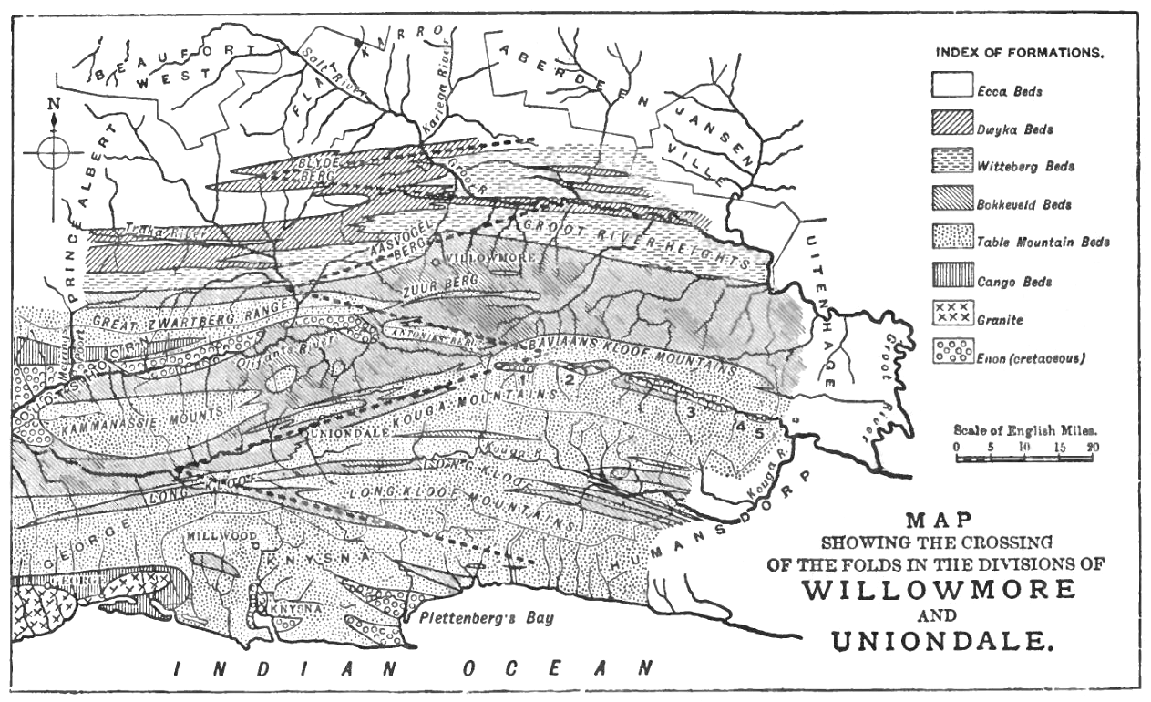
Map showing the crossing of the geological folds (dotted lines) in the divisions of Uniondale (Western Cape) and Willowmore (Eastern Cape), South Africa
Summary edit
| Description |
English: Figure from South African Geology - Schwarz - 1912 (Page 139) Fig. 39.—Detailed Map of the Folds where they splay out seawards to the east of the granite bosses of George. 1, 2, 3, 4, 5 are the fold-basins or fault-pits of Baviaan's Kloof. |
| Date | |
| Source |
 |
| Author | Schwarz, Ernest Hubert Lewis, 1873-1928 |
| Other versions |
 |
Licensing edit
|
This work is in the public domain in its country of origin and other countries and areas where the copyright term is the author's life plus 70 years or fewer. This work is in the public domain in the United States because it was published (or registered with the U.S. Copyright Office) before January 1, 1929. | |
| This file has been identified as being free of known restrictions under copyright law, including all related and neighboring rights. | |
File history
Click on a date/time to view the file as it appeared at that time.
| Date/Time | Thumbnail | Dimensions | User | Comment | |
|---|---|---|---|---|---|
| current | 17:48, 22 May 2016 | | 1,263 × 770 (1,017 KB) | Tobias1984 (talk | contribs) | User created page with UploadWizard |
You cannot overwrite this file.
File usage on Commons
The following page uses this file:
File usage on other wikis
The following other wikis use this file:
- Usage on en.wikisource.org